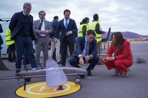
Docked Drone Operations in Alaska Showcased at NestGen 2025
During the “Autonomous Docked Drone Integration with GIS Systems in Alaska” session at NestGen 2025, industry professionals gathered to explore how docked drones have transformed environmental data collection and management across the vast Alaskan landscape. Experts from the Alaska Department of Transportation (DOT) and Esri shared insights into their innovative approaches.
Melany Wilson, a GIS Analyst at Alaska DOT, highlighted the challenges posed by the state’s immense geography, which makes it difficult to monitor numerous areas simultaneously. She reported that drone-in-a-box (DIB) solutions have become essential for capturing the imagery required for their projects.
Furthermore, safety remains a top priority for Alaska DOT as they often operate in hazardous locations, such as avalanche paths or flood sites. Wilson emphasized the invaluable role of drones in gathering critical data while keeping personnel out of harm’s way.
“Drone data has been producing unprecedented volumes of information; in fact, 90% of all data ever generated has emerged in just the last two years,” remarked Wilson. To support this initiative, her team currently operates 22 drones equipped with Skydio docks for photogrammetry and thermal data gathering.
The agency utilizes SiteScan for data management and dissemination across the state’s network. Wilson explained that the adoption of DIB technology facilitates streamlined data capture, enabling not only the DOT but also other state agencies to benefit from the collected imagery and video data.
According to both Wilson and her co-presenter, Cody Benkelman from Esri, this data can aid in disaster response planning. For instance, to manage natural disasters like avalanches that threaten key highways, Alaska DOT has begun deploying drones to assist in controlled avalanche projects—dropping explosives based on data gathered at critical locations.
Looking ahead, Alaska DOT aims to expand its drone operations, establishing routine flights to ensure the most current information is available. They are implementing a digital transformation strategy designed to transition towards fully autonomous operations, utilizing AI tools for enhanced environmental data extraction and emergency response guidance.
Wilson concluded, “Our ultimate objective is to evolve toward a more autonomous and responsive model, which allows us to precisely request specific data and apply analytical techniques to address key environmental queries.” The focus remains on delivering accurate, actionable data—whether tracking progress post-flood or assessing avalanche conditions—while ensuring that the state network has immediate access to this vital information.
Stay tuned to Commercial UAV News for more detailed coverage from NestGen 2025.