SimActive’s Correlator3D Empowers Dewberry to Integrate LiDAR and Imagery for Enhanced Mapping
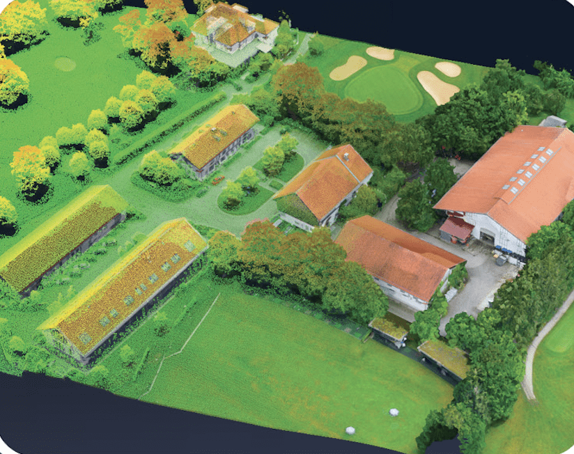
SimActive Inc. has announced that Dewberry, a prominent professional services firm, is utilizing its Correlator3D™ software to fuse LiDAR data with imagery for superior mapping outcomes. This integration enables Dewberry to create highly accurate deliverables, such as colorized point clouds, digital surface models, and orthomosaics, by combining LiDAR-derived elevation information with image-based color and surface details.

Ryan Ligon, Geospatial Technology Manager at Dewberry, stated, “We appreciate Correlator3D’s capability to merge multiple datasets and generate high-quality mapping products swiftly. Our projects range from a few flight lines to extensive area mapping, and Correlator3D accommodates all our needs, significantly simplifying our work.”
Dewberry employs dual sensor systems during aerial missions, capturing both LiDAR and imagery in one flight, ensuring complete coverage of various landscapes. In corridor mapping projects, imagery is utilized to colorize point clouds, aiding in vegetation encroachment monitoring. Near water bodies, Dewberry merges topobathy LiDAR with image-derived elevations to produce detailed surface models.
Correlator3D Supports Advanced Geospatial Workflows
Developed in Montreal, Correlator3D is an advanced photogrammetry software allowing users to process satellite, manned aircraft, and drone sensor data effectively. It features tools for aerial triangulation, point cloud creation, and the generation of orthomosaics, digital surface models (DSM), and digital terrain models (DTM). Additionally, it supports the extraction of 3D vector features and textured 3D models.
A key advantage of Correlator3D is its rapid processing capability for large datasets. By utilizing GPU technology and multi-core CPUs, the software accelerates production, enabling results to be obtained significantly faster than with other systems. Its workflow effectively supports various data fusion tasks, including the integration of LiDAR and photogrammetry—crucial for companies like Dewberry, which cater to both public and private sector clients with diverse mapping demands.
SimActive’s innovative solutions are deployed worldwide by leading mapping firms, engineering companies, and government agencies, earning a strong reputation for reliable software backed by exceptional customer support.
About Dewberry
Dewberry is a nationwide firm offering professional services in engineering, architecture, geospatial solutions, and consulting. With headquarters in Fairfax, Virginia, and over 2,000 professionals spread across more than 50 locations, Dewberry is recognized for its ability to tackle complex challenges and enhance communities through thoughtful design and technology-driven solutions.
About SimActive
Founded in 2003, SimActive Inc. is a Canadian software company known for its flagship product, Correlator3D, a patented photogrammetry platform designed to generate geospatial data from aerial imagery. SimActive’s technology supports a wide array of applications, including mapping, infrastructure monitoring, environmental analysis, and disaster management.
For more information about Correlator3D, visit www.simactive.com. To learn more about Dewberry, go to www.dewberry.com.
Read more: