Helsinki Tests New System to Enhance Drone Navigation Safety
The City of Helsinki is currently piloting advanced sensors aimed at monitoring GNSS signal disruptions within the city’s low airspace. This initiative is set to gather data from lower altitudes than previous studies.
Launched by Forum Virium Helsinki, the innovation division of the city, this half-year program focuses on understanding the interference affecting satellite-based GNSS positioning signals essential for drone operations. The primary goal is to assist local authorities in comprehending the conditions under which these interferences occur.
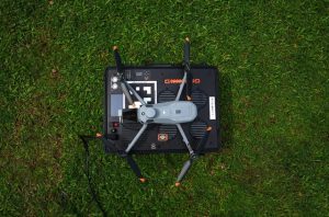
Real-time tracking is crucial for drones to maintain their designated flight paths. When GNSS signals fail, many smaller drones are programmed to return to their launch point instead of proceeding to their intended destination. Although some advanced commercial drones are equipped with visual positioning systems to facilitate navigation, this remains a novel technology that has not yet been widely adopted. Initial findings indicate that drones flying at lower altitudes face less signal interference compared to those operating at greater heights.
Enhancing Airspace Security
This project is anticipated to produce a comprehensive dataset that highlights the timing and locations of GNSS signal interferences. With the rising popularity of drones in urban settings, Helsinki is striving towards establishing a managed and safe lower airspace for aerial operations.
“We are in the nascent phases of investigating this phenomenon in urban low-altitude airspace. Data collection from our sensors has commenced, and we are currently analyzing this information,” explains Jukka Alander, a technical specialist at Forum Virium Helsinki.
The project collaborates with Finnish sensor technology company Sensoripaja. Five sensors have been deployed at altitudes ranging from 50 to 100 meters. This urban air mobility endeavor, known as CITYAM, is supported to enhance urban airspace management and facilitate the scaling of drone activities.
Once Forum Virium Helsinki and local authorities have thoroughly reviewed the pilot’s findings, they plan to disseminate their results and engage in discussions with significant national agencies, including the National Land Survey of Finland and the Finnish Transport and Communications Agency.
Discover more from sUAS News: Subscribe to receive the latest articles straight to your inbox!