Virtual Surveyor’s Smart Drone Surveying Software Now Integrated with Microsoft Office OneDrive
Introduction: Pioneering Drone Survey Collaboration for 2025
The arena of drone surveying is rapidly advancing, at the forefront of which is Virtual Surveyor. Known for its trusted software platform, used by experts across over 80 nations, the introduction of Virtual Surveyor Version 10.1 signifies a monumental leap in cloud-based data collaboration through its new integration with Microsoft Office OneDrive and Microsoft SharePoint. This evolution offers dramatic improvements in how drone surveyors handle their essential survey information.
Whether you are a seasoned geomatics engineer managing vast mining projects, a construction surveyor handling multiple locations, or a drone enthusiast keen on commercial UAV opportunities, this integration marks a pivotal development for operations. Here’s a look at what Virtual Surveyor is, why OneDrive integration changes the landscape, and how this partnership can enhance efficiencies.
1. What is Virtual Surveyor?
Virtual Surveyor is a sophisticated drone surveying software suite that converts raw UAV images into actionable, precise topographic data with speed. It covers the entire workflow process:
- Photogrammetry: Utilize the Terrain Creator app to transform drone imagery into high-quality orthomosaics and digital surface models (DSMs).
- Survey Tools: Convert these datasets into CAD-ready models, cut-and-fill maps, and calculate volumes using the core Virtual Surveyor app.
- Comprehensive Ecosystem: Projects progress from data collection to deliverable without needing additional software.
Its flexible pricing range accommodates both small enterprises and large corporations, from the „Valley” to „Peak” plans, aiming to make drone-based topographic surveys five times faster than conventional fieldwork while maintaining accuracy.
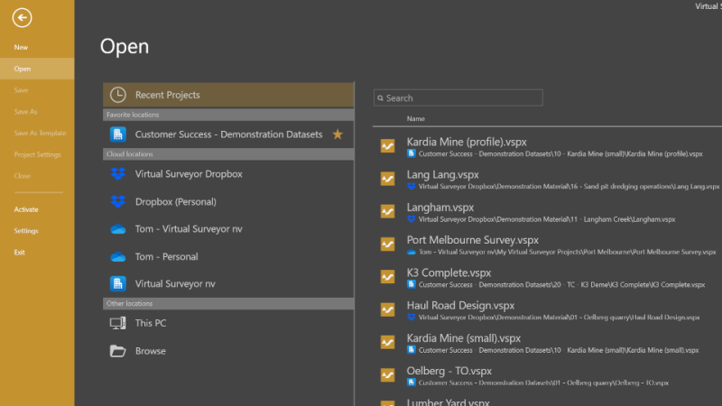
2. The Significance of OneDrive Integration
Imagine having your survey data accessible from any device with Virtual Surveyor—just as easily as editing cloud-stored Word documents. This is what OneDrive integration promises:
- Cloud-Centric Workflow: Save projects directly to OneDrive or SharePoint, with no added setup.
- Remote Access: Utilize files from any location—ideal for hybrid structures and project collaboration from different sites.
- Team Coordination: Establish shared folders for team access, promoting seamless feedback in widespread teams.
- Cost-Efficiency: Leverage Microsoft 365 subscriptions that often include storage, negating the purchase of a new cloud service.
Tom Op ‘t Eyndt, CEO of Virtual Surveyor, stated: „Our integration with OneDrive is meant to simplify and optimize project access using Cloud storage already familiar to many users. Virtual Surveyor data can be saved in cloud locations, much like Word or Excel files.”
This integration cuts through barriers. No longer will giant files require emailing or local drive complications—a necessary advancement in today’s expansive, time-sensitive project landscapes.
3. Effortless Project and File Management
Here’s how it simplifies file management:
- Configuration-Free: Select your OneDrive/SharePoint location when saving or opening projects—no additional steps.
- Portable Data: Start on one device and continue on another; files remain accessible while logged into OneDrive.
- Collaboration Plans: Enable folder sharing with users where updates synchronize automatically.
- Security: Utilize Microsoft’s robust cloud security measures, including permission settings.
This integration is immensely beneficial for firms managing numerous project locations or subcontractors requiring up-to-date terrain data without cumbersome file exchanges.
4. Practical Applications and Use Scenarios
This integration in action:
- Mining & Quarrying: Geological teams document drone imagery, analyze volumes, and directly share cut-and-fill maps with engineers remotely.
- Construction Earthworks: Managers and engineers assess project progress collaboratively, noting changes or discrepancies using synced data.
- Stockpile Inventory: Inventory managers globally can evaluate and report on material volume from unified databases.
- Disaster Response/Insurance: Swiftly gather, process, and distribute high-resolution orthophotos for damage assessment or recovery without file transfer constraints.
Case Example: A European construction firm used to transport survey data by drives across 300 km between branches. With OneDrive, both sites now access the same current datasets, reducing project delays and data loss risks.
5. More than Just Storage: Enhanced Survey Features
Beyond storage capabilities, Virtual Surveyor excels with its analytics and tools:
- 3D Surveys: Automatically generate DSMs and orthomosaics for analysis and export.
- Earth Volume Calculations: Quickly determine necessary earthwork volumes for project planning and billing.
- Stockpile Analysis: Calculate material tonnage, essential for inventory control.
- Planimetric Tools: From Version 9.5, surveyors can map 2D features, accelerating projects requiring both 2D and 3D outputs.
- Design and Export Tools: Includes drawing instruments and provides data in various formats like CAD and GIS to meet diverse client requests.
- Versatile Licensing: Offered on a flexible, non-binding basis to suit distinct needs.
6. Why This Matters for Drone Surveying’s Future
This integration isn’t simply functional enhancement; it signals a future vision for digital survey teams to be ambitious, cloud-integrated, and collaboratively seamless. As the industry expands, creating an environment for access anywhere, multi-user collaboration, and secure data storage becomes essential.
7. Expert Strategies to Maximize Virtual Surveyor + OneDrive
- Set Organizational Structures Early: Develop a clear folder hierarchy in OneDrive for smoother operations.
- Conduct Team Training: Educate users on efficient cloud collaboration practices, including handling permissions and versioning.
- Automated Backups: Utilize OneDrive’s version history to safeguard critical surveys.
- Combine Tools: Coordinate Virtual Surveyor with CAD, GIS, or BIM software for an efficient workflow.
- Experience Before Commitment: Take advantage of the 14-day free trial to explore different plan offerings and match them to your business’s size and requirements.
8. How to Begin
New Users: Download Virtual Surveyor from their website, activate the free trial, and integrate with OneDrive during setup.
Current Users: Upgrade to Version 10.1 to enable OneDrive integration—no additional plugin needed.
Select Your Plan: From „Valley” for basic needs to „Peak” for advanced applications—each option comes with distinct features.
9. The People Driving Virtual Surveyor
Virtual Surveyor represents the dedication of a passionate team based in Belgium. The goal, as CEO Tom Op ‘t Eyndt expresses, is not to replace surveyors but to enhance their ability to interpret terrain while utilizing computers’ calculation capabilities. Feedback shapes features, like OneDrive and planimetric tools, reflecting real-world demands.
10. Conclusion: Embracing a New Era of Survey Collaboration
If you’re active in or contemplating entering drone mapping, Virtual Surveyor’s OneDrive integration marks a significant stride forward in data management and collaboration. Designed for accuracy and flexibility, this cloud-integrated approach effectively connects your data, team, and ambitions worldwide.
Explore the potential of drone surveying’s future with a free trial, integrate with OneDrive, and experience the ease of cloud-based collaboration.
This article intends to guide you through the latest drone survey technologies. Visit Virtual Surveyor’s official site for product comparisons, tips, or to commence a free trial. Their team aims to help you capitalize on your data, drones, and business objectives.