DJI Ban on the Horizon? What It Could Mean for Surveyors and for 3Dsurvey
Few topics have stirred as much debate among surveyors and drone professionals in 2025 as the looming possibility of a DJI ban in the United States. DJI, with its iconic Phantom, Mavic, and Matrice lines, dominates the world of professional aerial mapping, surveying, and photogrammetry. But in recent years, mounting concerns over data security, supply chain integrity, and international politics have cast a long shadow over DJI’s future in major markets—especially the U.S.
If you’re a surveyor, GIS specialist, or a user of platforms like 3Dsurvey, you’ve likely followed the news, fielded nervous questions from clients, or maybe even delayed a hardware upgrade waiting for clarity. Let’s break down the latest developments, what’s actually at stake, how industry players are preparing, and what surveyors and 3Dsurvey users can do today to stay ahead of the curve.
The Politics Behind the DJI Ban: Not Just a Rumor Anymore
First, let’s clear up what’s fact and what’s fiction. As of July 2025, there is no official nationwide ban on DJI drones in the United States, but the industry is on high alert. This isn’t just an idle threat or a trial balloon—multiple layers of legislation, from executive orders to the 2025 National Defense Authorization Act (NDAA), have set the stage for a potential ban by the end of this year. Here’s the core of the current situation:
- Government scrutiny: U.S. lawmakers and agencies have raised concerns about DJI’s alleged ties to the Chinese government and the potential for drone data to be exfiltrated to foreign servers.
- Legislative gridlock: The NDAA 2025 mandates a formal review of DJI by a U.S. national security agency. If no agency steps up to complete this review by December 23, 2025, DJI drones will be automatically banned by being added to the FCC “Covered List.” This would block new DJI drones from being imported, sold, or (potentially) networked in the U.S.
- Customs & regulatory friction: Even before any formal ban, shipments of certain DJI drones are being delayed or blocked at U.S. customs, linked to enforcement of the Uyghur Forced Labor Prevention Act. The FCC has also paused new equipment authorizations for several DJI models, already limiting the inflow of newest hardware.
The bottom line: Time is running out. No agency has yet started the required review. If nothing changes, a default ban goes into effect at year’s end.
What Does This Mean for Surveyors and Mapping Professionals?
DJI drones have become the backbone of surveying, mapping, photogrammetry, and construction monitoring thanks to their reliability, image quality, and accessible pricing. Surveyors have built entire workflows and training programs around DJI products. So, what might the ban mean on the ground?
1. Immediate Uncertainty and Supply Chain Disruptions
- Resellers & inventory headaches: Some DJI shipments are already getting stuck at customs. Resellers are seeing delays, and certain models may quietly vanish from U.S. shelves. For surveyors, this means less predictable access to spare parts or replacement units.
- No new models: With the FCC currently suspending new DJI equipment authorizations, the latest Matrice or Mavic upgrades may simply not hit the U.S. market. That’s especially painful considering DJI’s frequent and market-leading innovations.
2. Cost and Technology Gaps
- Alternatives are pricier: DJI’s domestic and allied competitors—like Skydio, Freefly, or Quantum Systems—often charge higher prices for similar or less mature technology. Some surveyors could face a steep increase in equipment costs, or be forced to use drones that don’t match DJI’s precision and ease-of-use.
- Disrupted innovation: Many third-party software platforms (including photogrammetry suites like 3Dsurvey) have optimized their workflows for DJI hardware. A sudden shift could mean time-consuming adaptations, software rewrites, or feature gaps—at least in the short term.
3. Legacy Fleet and Secondary Market Dynamics
- Older DJI drones still fly: The ban, as currently framed, would not outright ground every DJI aircraft already in the country, but it would block new imports, parts, and possibly software updates. This could raise maintenance costs and impact operational reliability.
- Rising value of used DJI drones: Ironically, a ban could inflate the price of good-condition used DJI drones as supply dries up—much like what happened when older iPhones or GPUs gained cult status.
4. Business Disruption Across Industries
The impact isn’t limited to surveyors:
- Real estate: Listing agencies and developers depend on DJI for affordable, stable aerial photography.
- Public safety, agriculture, and infrastructure: Emergency responders, farmers, and utility inspectors have all come to rely on DJI’s fleet and automation tools for tasks ranging from post-storm assessments to yield estimation.
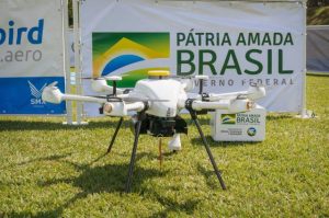
- Government and research: The U.S. Department of the Interior has reported diminished drone capacity and higher costs after earlier restrictions on DJI purchases, forcing agencies to use helicopters or scale back some natural hazard operations.
Why the Uproar? The Case for and Against the Ban
National Security Arguments
Proponents of the ban argue that DJI’s dominance in the U.S. drone market poses a strategic risk:
- Data security: Fears that sensitive imaging or GIS data could be routed back to Chinese servers.
- Supply chain: Overreliance on a single foreign supplier for critical infrastructure monitoring.
Critics’ Rebuttal
- No hard evidence: To date, there’s no public evidence of DJI drones being used for systematic data exfiltration.
- Economic harm: A sudden ban risks harming thousands of small businesses, undermining innovation, and raising costs across the board.
- Gaps in market readiness: U.S. and allied alternatives may not be ready to fill the void in capacity, particularly in terms of affordability and feature set.
How Is 3Dsurvey Preparing? Adaptation, Not Panic
3Dsurvey, like many leading photogrammetry and mapping platforms, built its early success on compatibility and tight integration with DJI hardware. The company serves thousands of professionals who use DJI drones daily for mapping, volume measurements, and construction monitoring.
Recognizing the growing regulatory storm, 3Dsurvey has taken proactive steps:
- Hardware-agnostic philosophy: 3Dsurvey has been investing in broader integration efforts, ensuring that its software works smoothly with a range of drone types—DJI or otherwise. This means surveyors can pivot to non-DJI alternatives with minimal workflow disruption.
- Partnering with emerging players: The platform is working with new drone manufacturers to ensure that mapping professionals have reliable options when (or if) they need to transition away from DJI.
- User support and education: 3Dsurvey is ramping up outreach efforts—webinars, help articles, and direct support—to help customers understand their options, adjust to possible regulatory changes, and make the most of existing hardware.
“We can’t control the laws, but we can control how prepared our users are. Our goal is to make sure surveyors stay productive and competitive, whatever the next year brings.”
What Should Surveyors and Drone Professionals Do Now? Expert Tips
If you’re worried about the future of your fleet or mapping workflows, here’s how to bulletproof your business:
- Stay informed: Keep up to date with both federal legislation and agency rule changes. Reliable sources include Commercial UAV News, the FAA, and trade organizations.
- Audit your inventory: Assess how reliant your operations are on DJI hardware. Identify which applications could easily transition to other platforms if necessary.
- Evaluate alternatives: Research other drone manufacturers and see which models already integrate with your key software (like 3Dsurvey). Even if you’re not ready to buy, being familiar with specs and price points is smart risk management.
- Engage with your vendors: Ask mapping software and hardware suppliers how they are preparing for the potential ban. Insist on clear roadmaps—don’t accept “wait and see” as an answer.
- Maintain compliance: Review your regulatory responsibilities under FAA Part 107 and any state-level drone laws, as these may shift with the regulatory landscape.
- Consider training investments: Prepare your pilots for new workflows, hardware interfaces, or photogrammetry calibration routines. Early adaptation can be a competitive advantage if the market shifts quickly.
The Human Side: Navigating Disruption Together
No matter how high-tech the drone industry becomes, it’s ultimately about people—surveyors out in the field before dawn, mapping teams processing terabytes of imagery, developers working overtime to keep software in sync with hardware changes.
Within companies like 3Dsurvey, the team brings together drone pilots, geospatial engineers, programmers, and support specialists—many of whom started as end users themselves. Their stories mirror those of their clients: hustling to meet deadlines, adapting to regulatory pivots, and partnering with customers to solve tricky, last-mile mapping challenges.
“People call us about the DJI ban not just because they’re worried about their drones,” says a support engineer at 3Dsurvey, “but because they don’t want to lose the edge their business has built up over years. Our job isn’t just tech support—it’s helping clients keep moving forward.”
Case in point: In early 2025, a Texas-based surveyor faced a stalled project when a critical Matrice shipment was delayed. With coaching from 3Dsurvey, they successfully switched to a domestic drone model and retrained their pilots, saving a six-figure contract—and picking up some new skills in the process.
Looking Ahead: Adaptation, Diversification, and Resilience
Will the U.S. really ban DJI drones? The regulatory clock is ticking, and unless a government agency steps up to conduct the NDAA-mandated review, the answer by the end of 2025 may indeed be “yes.”
But the lesson from surveyors, drone professionals, and companies like 3Dsurvey is clear: Resilience comes from anticipation and adaptation. The industry has weathered rapid change before—from analog photogrammetry to RTK GNSS, from ground-based total stations to fleets of autonomous UAVs.
In the words of one industry insider: “Drones are here to stay. The brands may change. The community’s ingenuity is what will keep mapping and surveying flying high.”
So, whether you’re bracing for tighter regulations, plotting a hardware upgrade, or just hoping for business as usual, remember: a smart, well-prepared team will always land on its feet—no matter which drones are in the sky.
Written by a team that lives and breathes UAV mapping, for surveyors who understand that the only constant in this business is change—and the only way forward is together.