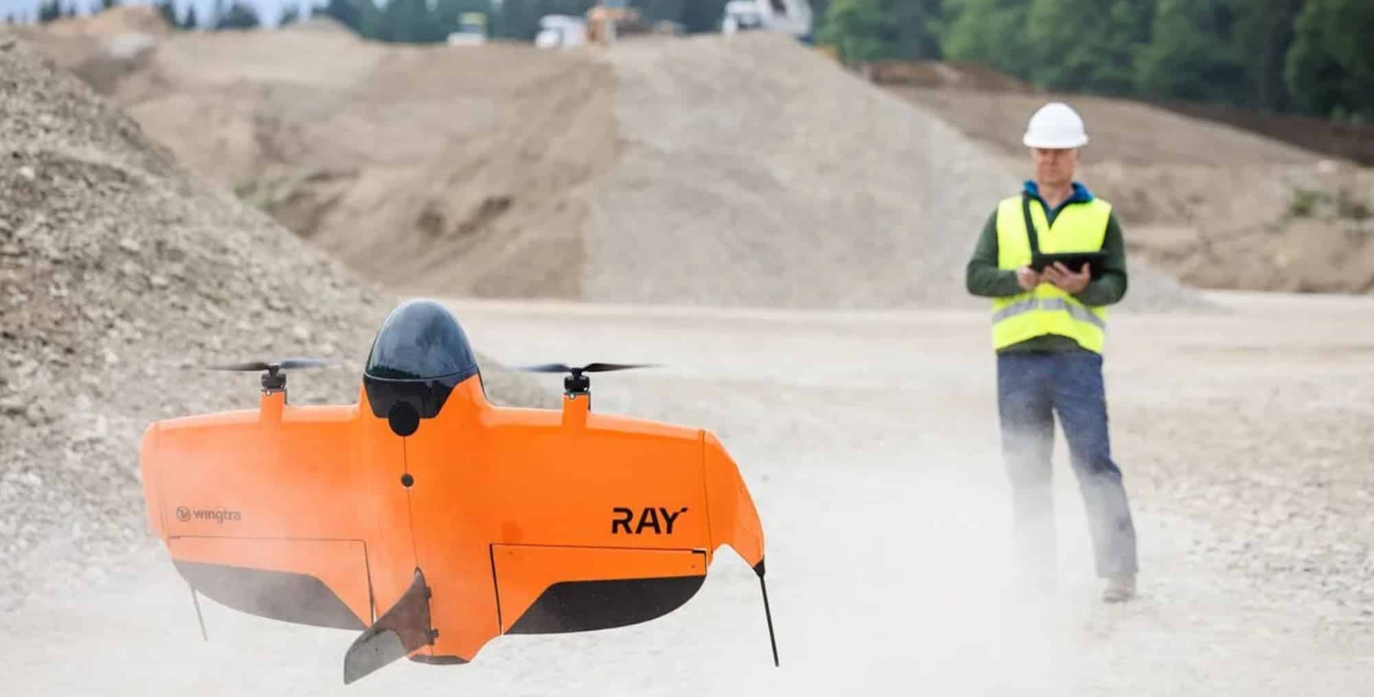
WingtraRAY: The Cutting-Edge Survey Drone Revolutionizing Efficiency
If you’re involved in surveying, mapping, or urban planning, you are aware of the industry’s constant demand for speed, accuracy, and compliance. The newly launched WingtraRAY drone, introduced by Wingtra in July 2025, is poised to redefine these standards. As a VTOL (vertical takeoff and landing) platform, it aims to push boundaries and enable modern survey teams to achieve unprecedented levels of efficiency and reliability.
Unraveling the WingtraRAY: A Leap in Survey Drone Technology
Let’s delve into what makes the WingtraRAY a groundbreaking advancement in commercial aerial surveying. Combining its exceptional performance, compliance features, and real-world applicability, you’ll have the insights needed to determine if it’s suitable for your upcoming projects.
Addressing Key Challenges: Why Choose WingtraRAY?
Survey teams have historically contended with sluggish workflows, complex regulatory requirements, especially for urban flights, and cumbersome equipment swaps for various tasks. The WingtraRAY promises to solve these issues with rapid surveys, a flexible single-platform solution, and unmatched urban compliance.
“Our survey clients look for solutions that ameliorate their challenges and offer quick ROI. They also require a system that is easy and safe for every pilot. WingtraRAY encapsulates these features in an economical package.” —Maximilian Boosfeld, Wingtra CEO
Performance: Accelerated Speed, Comprehensive Coverage, and Enhanced Workflow
- Rapid Data Capture: The WingtraRAY can document 100 hectares (250 acres) within a mere 10 minutes, offering a 40% speed enhancement over its predecessor, the WingtraOne GEN II. For larger sites, it can cover 550 hectares (1,360 acres) during a 59-minute flight with the MAP61 sensor at 120 meters altitude, achieving an impressive ground sample distance of 2.7 cm per pixel.
- Faster Than Multirotors: The WingtraRAY completes surveying tasks up to 10 times faster than standard quadcopters and 30 times faster than terrestrial methods.
- Exceptional Accuracy: Leveraging post-processed kinematic (PPK) correction and GNSS, it delivers accuracy between 1-3 cm without ground control points (GCPs), significantly saving time on extensive or hard-to-reach areas.
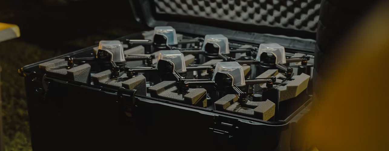
- Hot-swappable Payloads: The WingtraRAY accommodates six specialized payloads, including a high-res 61MP RGB, LIDAR for DTM, and multispectral sensors for agriculture. Sensors can be swapped effortlessly while maintaining the airframe.
- Unified Workflow Platform: From planning missions to delivering GIS/CAD-ready data, the WingtraRAY ensures a seamless workflow, using the connected WingtraCLOUD platform to enable same-day data processing and delivery.
Urban Compliance: Revolutionary Legal Sanction
Conducting surveys over urban areas or over people (OOP) traditionally poses significant legal and logistical hurdles. The WingtraRAY simplifies this challenge:
- Parachute Add-on: Facilitates category 3 OOP flights legally across 98% of U.S. regions, supporting C6 certification under EASA STS-02 in Europe.
- Pre-approval for Infrastructure: Its classification as Blue UAS and AUVSI Green clears substantial administrative paths, expediting projects, including U.S. government and airport tasks.
- Augmented Safety Features: Equipped with obstacle avoidance, a backup battery, and comprehensive guidance systems, it assures operational safety in congested airspaces.
Practical Application: Who Benefits Most from WingtraRAY?
With its expansive range, precision, and swappable payloads, WingtraRAY serves as a versatile tool for:
- Construction Monitoring: Capture progress and assess volumes efficiently for earthwork evaluations.
- Mining Activities: Quickly evaluate stockpiles safely, even amidst active operations or challenging weather conditions.
- Agriculture Sector: Utilize multispectral analysis to monitor extensive crop health.
- Urban and Infrastructure Inspection: Legally survey city blocks, bridges, and airports with mm-level precision using the INSPECT payload.
- Emergency Management: Provide rapid, extensive situational awareness for disaster response teams.
Following a test flight, a European construction client noted: “Tasks that previously demanded days with manual GPS or several drone launches now take one coffee break and a button press. Our client reporting has transformed from days to a matter of hours.”
Technical Deep-Dive: A Glance at Specifications
| Feature | WingtraRAY Specification |
|---|---|
| Drone Type | Tailsitter VTOL (vertical take-off & landing) |
| Max Take-off Weight | 5.2 kg (11.5 lb) |
| Payload Capacity | 1,250 g (2.75 lb) |
| Wingspan | 125 cm (4.1 ft) |
| Flight Time | Up to 59 minutes (with photogrammetry sensors); 45 min with LIDAR |
| Max Coverage (1 Flight) | 1,360 acres (550 ha) at 120m altitude |
| Wind Resistance | 12 m/s (27 mph) sustained |
| Max Altitude | 5,000 m (16,400 ft) ASL |
| Adaptive Speed | 16–22 m/s (36–49 mph) |
| Navigation | Multi-band GNSS (GPS L1/L2, GLONASS, Galileo, BeiDou) |
| Control Range | 10 km (LOS), unlimited over LTE |
| Operating Temperature | Not specified, but robust for field ops |
| Case Size (Transport) | 130 × 70 × 34 cm (51.2 × 27.6 × 13.4 in) |
Diverse Sensor Options: Pick Your Payload, Master the Task
- MAP61 / SURVEY 61: 61MP full-frame RGB, ideal for comprehensive high-res mapping including runway inspection.
- LIDAR: Utilized for generating digital terrain models in forested or mountainous regions.
- Multispectral: Aimed at agricultural, forestry, and environmental surveys.
- INSPECT: Detailed mm-level assessments at low altitudes for infrastructure inspections.
“The need for different drones per sensor is eliminated. Just hot-swap in the field and proceed!” —Feedback from Surveyors
Setup, Workflow, and User Experience: Tailored for Teams
- Quick Preparation: Ready to launch in under 5 minutes, enabling operation by a single person.
- VTOL Adaptability: No runway requirement for take-off, which is advantageous in urban, restricted, or challenging terrains.
- Guided Assistance: Comprehensive system guidance and user-friendly software make WingtraRAY manageable even for non-experts, decreasing the learning curve and minimizing error-related rework.
- Automated Workflow: Includes automatic ground control and data synchronization, with CAD/GIS-ready outputs, removing the need for manual adjustments.
Profitability and User Testimonials: The Bold Choice Pays Off
Wingtra suggests the RAY system “pays for itself within months” due to its swift project turnover, allowing businesses to handle more jobs with fewer site visits. Early adopters in the mining and infrastructure sectors acknowledge a tangible improvement in their competitive advantage and client satisfaction, crediting the rapid and accurate deliverables.
On a lighter note, the drone’s speed has become a meme among surveyors, humorously noted as, “It flies so fast, a coffee doesn’t get cold before results are ready!” In an industry with tight schedules, this combination of speed and simplicity is invaluable.
Safety, Reliability, and Compliance: Smoother Urban Operations
The WingtraRAY isn’t solely focused on speed. Its parachute system and extensive redundancy—including obstacle avoidance and backup battery—ensure compliance for OOP operations in both the U.S. and EU, eradicating the need for most waivers.
The Blue UAS and AUVSI Green certification broadens opportunities with government projects, eliminating months of bureaucratic delays.
Implications for Surveyors, Engineers, and Urban Planners
- Increased Opportunities, Minimal Hassle: Secure more contracts through prompt compliance and same-day deliveries.
- Fewer Errors: A streamlined workflow reduces human mistakes and rework.
- Flexible Teams: From veterans to newcomers, anyone can operate the drone efficiently and safely.
- Long-Term Investment: With its modular payload capabilities, robust compliance, and cloud integration, it remains at the forefront of technology.
The Human Element: Wingtra’s Approach to Innovation
Wingtra prides itself on Swiss precision engineering and a global customer network, tailoring products based on feedback from busy surveyors worldwide. Wingtra’s mantra: “Address customer pain points and innovate past competitors.” Early users appreciate not only the technology but also the focused support, training, and post-sale service provided by Wingtra.
Pop Culture Reference: Drones That Would Awe Tony Stark
Fans of sci-fi drones from media such as “Blade Runner 2049” or “Watch Dogs: Legion” won’t be disappointed with the WingtraRAY. It merges futuristic features with operational practicality, standing out as an exceptional tool that is both thrilling and dependable.
Summary: Is WingtraRAY Right for You?
For teams seeking the most compliant and fastest survey drone available, WingtraRAY offers a scalable platform that supports business growth. From massive construction projects to dense urban environments, it elevates the potential for professional drone surveying, ensuring productivity and peace of mind.
Want to engage in efficient mapping over a coffee break and navigate urban airspace without bureaucratic burdens? The WingtraRAY is your gateway to cutting-edge aerial surveying.
Interested in witnessing a demo or receiving a customized workflow review? Reach out to the Wingtra team or trusted partners to join a community committed to establishing fast, precise, and legally compliant mapping as the industry benchmark.
Disclaimer: Technical details are based on sources available as of July 2025 and may be updated. For current regulatory advice, consult your local aviation authority.