Artificial intelligence (AI) and LiDAR (Light Detection and Ranging) are transforming the landscape of utility infrastructure. This guide explores how AI-driven LiDAR technology is fostering safer grids, innovative planning, and predictive management that seemed like science fiction just a few years ago.
From Static Data to Dynamic Insight: Why AI + LiDAR is a Game Changer
Utility sectors such as power, water, and telecom form essential parts of society, but managing them becomes increasingly challenging as infrastructure ages and climate conditions change. LiDAR technology steps in here.
Employing millions of laser pulses each second, LiDAR generates highly detailed 3D maps of terrains, structures, and utilities, illuminating what conventional cameras cannot capture. However, managing these large-scale data sets manually is inefficient.
AI revolutionizes this scenario. Advanced algorithms like neural networks, pattern recognition, and edge computing assist utilities to:
- Automatically classify assets, processing vast 3D data within hours instead of weeks.
- Quickly identify anomalies, reducing human errors through automated systems.
- Effortlessly integrate new data, enabling real-time, updated models without extensive reprocessing.
Ultimately, utilities receive actionable insights rapidly, empowering preemptive action.
Real-World Impacts: What AI-Powered LiDAR Delivers
AI and LiDAR synergy not only boosts technology but revolutionizes utility design, maintenance, and management.
- **Predictive Maintenance:** AI and LiDAR predict vegetation overgrowth, corrosion, and structural issues, allowing pre-emptive maintenance and preventing failures.
- **Faster Outage Response:** By merging LiDAR data with GIS systems, utilities identify issues precisely and deploy resources effectively.
- **Enhanced Safety:** Accurate geospatial data enhances worker deployment safety and reduces accidental damage risks.
- **Environmental Resilience:** AI models forecast wildfire, landslide, and flood risks, aiding utility emergency plans.
Case Study Example: A major US utility in California uses AI-powered LiDAR for wildfire threat assessment, inspecting live 3D models from drones instead of outdated satellite images. This approach results in fewer outages and quicker power restoration.
The Workflow: How It All Comes Together
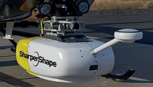
- Data Collection: Drones and helicopters gather detailed LiDAR scans across the grid.
- Automated Processing: AI analyzes the ‘point cloud’ data to classify components like wires, vegetation, and towers.
- Model Update & Integration: New data integrates with past scans, creating a dynamic ‘digital twin’ of assets.
- Insights & Action: Real-time reporting and alerts guide maintenance, planning, and stakeholder communication efficiently.
Key Benefits and Value Propositions
- **Enhanced Accuracy:** LiDAR ensures high precision in surveys, minimizing errors in infrastructure measurements.
- **Operational Efficiency:** Automating inspections reduces the time needed, freeing human talent for more valuable tasks.
- **Safety and Risk Management:** Workers avoid hazardous situations, and risk modeling minimizes surprises during fieldwork.
- **Cost Savings:** Though initial investments are high, AI and LiDAR reduce downtime and emergencies, delivering significant ROI.
- **Sustainability:** Effective monitoring fosters responsible environmental management and reduces emergency interventions.
The Democratization of Smart Tools
Once exclusive to large utilities, these advanced solutions are becoming accessible as sensor costs decrease and AI becomes more user-friendly. Even smaller entities can leverage cloud processing platforms, bridging the innovation gap in utility modernization.
Next-Gen Features and Future Directions
- **Predictive Analytics:** AI will project tree growth rates around lines and equipment risk using LiDAR data.
- **Edge Processing:** In-field real-time classification on drones accelerates decision-making.
- **Automated Integration:** LiDAR data increasingly connects with various digital systems, augmenting fieldwork with augmented reality.
The Human Side: Teams, Clients, and Culture
Infrastructure projects thrive on combined traditional expertise, data science, and hands-on technical skills. Our approach includes comprehensive client onboarding, expert-backed insights, and success stories, enhancing utility management significantly.
Common Concerns, Misconceptions, and Real-World Answers
**Is it safe and reliable?** Yes, LiDAR is a contactless method providing accurate data without physical risks, supported by AI which enhances problem detection.
**What about privacy and regulation?** LiDAR data collection complies with privacy laws and safety regulations, focusing on object data rather than personal information.
**Is AI just a buzzword?** AI is proven effective for classification and risk prediction, beyond mere demonstrations.
**What if we’re small?** Modular, cloud-based solutions allow smaller utilities to access AI advantages, scaling affordably.
How to Start: Expert Tips
- **Pilot with Specific Use-Cases:** Begin with projects where returns are clear.
- **Pick Partners Who Know Utilities:** Domain expertise is crucial alongside AI capabilities.
- **Invest in Training:** Equip teams with necessary tech skills.
- **Plan for Integration:** Ensure platforms integrate with existing management systems effectively.
In Summary: Why Smart Data Makes for a Smarter Grid
As grids expand and climate challenges grow, all utilities need precise, timely data. AI-powered LiDAR provides this, transforming utility management and establishing itself as essential for modern infrastructure.