Photogrammetry vs. LiDAR: Choosing the Right Tool for the Job – Expert Insights from Dr. Philippe Simard
Making the crucial decision between photogrammetry and LiDAR is essential for professionals engaged in mapping, surveying, construction, and geospatial fields. The choice affects accuracy, speed, cost, and even the feasibility of projects. Here, with insights from Dr. Philippe Simard, CEO of SimActive and an authority in photogrammetric software, we explore the strengths, limitations, and applications of both technologies — and how to select the most suitable tool for each task.
Understanding Photogrammetry and LiDAR
Photogrammetry involves deriving measurements and 3D models from photographs. It uses high-resolution images taken from drones or aircraft to recreate real-world surfaces by triangulating points across overlapping images, resulting in detailed 3D models and maps derived from accessible technology.
LiDAR (Light Detection and Ranging) utilizes pulsed laser beams to determine the distance to objects. Each laser pulse creates a “point cloud” — millions of precise 3D points that represent terrain, structures, and vegetation in detail. Typically mounted on specialized drones or aircraft, LiDAR excels in challenging environments like dense forests and rugged terrains.
Core Differences: Mechanisms of Action
| Feature | Photogrammetry | LiDAR |
|---|---|---|
| Data Capture | Overlapping images + triangulation | Direct laser measurements (point cloud) |
| Accuracy | Moderate to high (environment-dependent) | High, millimeter-level |
| Cost & Equipment | Lower cost, accessible cameras | Higher cost, dedicated devices |
| Lighting Needs | Requires good, even lighting | Operates in low/no light, unaffected by lighting |
| Visual Realism | Highly photorealistic, true-color | Accurate geometry, basic visuals |
| Speed/Efficiency | Slower capture & processing | Fast scanning, minimal setup |
| Ease of Use | Steep learning curve, manual image collection | More automated (higher initial investment) |
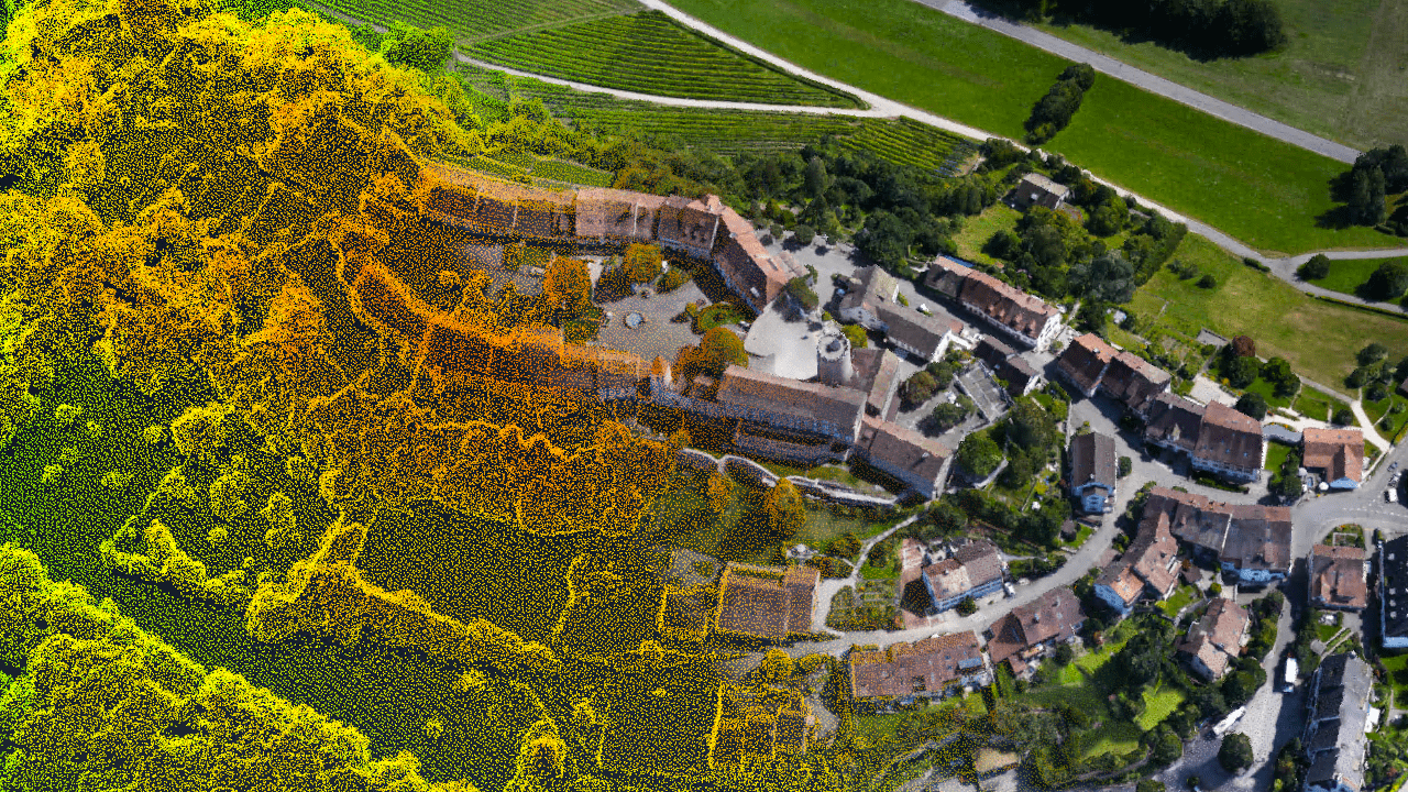
Photogrammetry constructs geometry by analysing visible surfaces, whereas LiDAR measures directly, often “seeing” through light vegetation to capture the true ground.
Analysis of Strengths, Limitations, and Preferred Use Cases
Photogrammetry: Accessible Visual Excellence
Pros:
- Cost-effective: Most modern drones can be used for photogrammetry, thanks to quality cameras.
- High visual realism: Produces detailed, true-to-color models, ideal for visualization, documentation, and asset management.
- Flexibly scalable: Easily adapts to large areas with more images, with a lower entry cost.
Cons:
- Lighting dependency: Dependent on strong, uniform lighting.
- Vegetation challenges: Struggles with capturing the ground beneath foliage or varied terrain.
- Processing time: Image alignment is computing-intensive, often time-consuming.
Best Applications: Urban planning, construction monitoring, real estate visualization, orthomosaics, and projects in clear terrains.
LiDAR: Precision Expertise
Pros:
- High accuracy: Achieves millimeter precision.
- Lighting independence: Functions irrespective of lighting conditions.
- Vegetation penetration: Captures underlying topographies.
- Rapid scanning: Efficiently covers complex areas.
Cons:
- Cost: Requires significant investment in specialized technology and skill.
- Visual limitation: Lacks detailed color fidelity.
- Size constraints: Equipment and payloads are heavier.
Best Applications: Forestry, infrastructure inspection, flood models, archaeological mapping, and “bare earth” surveys underneath vegetation.
Accuracy Comparison
While photogrammetry achieves horizontal accuracy of up to 1 cm, with vertical precision around 2–4 cm, LiDAR excels with horizontal and vertical accuracy ranging from 1–3 cm, particularly useful in vegetated or uneven terrains.
Cost, Scalability, and Workflow Considerations
- Photogrammetry: Initial low cost, suitable for various drones. Software options cater to different business sizes.
- LiDAR: Significant initial investment, but quickly justified for difficult conditions needing reliable data.
Photogrammetry requires careful planning and carries sensitivity towards environmental conditions; LiDAR, meanwhile, is streamlined but demands expertise.
Integrating Photogrammetry and LiDAR
“By merging LiDAR’s precision with photogrammetry’s visual data, users benefit from comprehensive 3D models valuable for a host of applications, including construction and conservation,” states a mapping expert.
Examples:
- Archaeology: LiDAR uncovers hidden structures while photogrammetry provides context.
- Forestry: LiDAR measures tree dimensions; photogrammetry creates canopy models.
- Engineering: LiDAR supports precise design, photogrammetry enables renders.
Dr. Philippe Simard: Transforming Photogrammetry
Dr. Simard, CEO and co-founder of SimActive, has been pivotal in transforming the field of digital photogrammetry. Beginning with defense contracts in 2003, his Canadian startup has expanded globally, installing in over 100 countries and offering crucial support to numerous industries.
Notably, SimActive’s software Correlator3D has empowered countless users to complete tasks efficiently using affordable drones. Dr. Simard’s philosophy underscores the need for innovation: “There are around 20 steps in photogrammetry, with innovation vital at each… reliable results must adapt alongside changing technologies.”
Guidance for Selecting the Appropriate Method
- Assess Terrain and Aims: Overgrown, complex terrains favor LiDAR; open sites suit photogrammetry.
- Data Necessities: LiDAR for precise accuracy beneath canopies; photogrammetry for high-resolution visuals.
- Envision Long-Term Needs: LiDAR suits regular challenging sites; photogrammetry for infrequent tasks.
- Training Considerations: Build on existing workflow familiarity. Considering both? Numerous platforms now offer data fusion support.
Conclusion: Tailoring Technology to Needs
The ideal tool transcends specifications, addressing your ambitions, environment, and team’s skill set. As each has revolutionized mapping and 3D modeling, Dr. Simard’s leadership continues to drive hybrid innovations, marrying the best of both technologies.
For expert advice or to learn more about implementing these technologies practically, reach out to industry specialists—success hinges on partnerships as much as tools.