Drone Mapping Transforms Police Crash Investigations: A Blue Marble Geographics Case Study
Drones and Crash Forensics: A Revolution on the Roadside
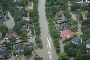
Envision the scene of a multi-vehicle accident: emergency lights flashing, lanes blocked, drivers growing frustrated, and investigators meticulously working with traditional tools. Now, picture a different scenario where a drone quietly hovers over the site, taking numerous high-resolution images, while officers efficiently manage the process. This is the future of police crash investigation, as exemplified by the Windham, Maine Police Department utilizing Blue Marble Geographics’ mapping technology.
Why Drone Mapping is a Game Changer
Traditional crash investigations are challenging, risky, and lengthy. Officers collect evidence manually, often risking their safety amidst moving traffic and harsh elements. The data collected is valuable but often incomplete or inconsistent due to various constraints.
Drone mapping offers significant improvements:
- Quick, high-resolution data gathering: Drones capture comprehensive, overlapping images from above, allowing for swift reconstruction of even the most complex accident scenes.
- Enhanced safety for officers and the public: With remote control, less time is spent in hazardous situations, particularly on busy roadways or in dangerous environments.
- Clear digital evidence: The drone’s aerial view provides complete spatial context, eliminating ambiguities in documentation.
The Windham Police Department Approach: Step-by-Step
The Blue Marble Geographics case study provides an in-depth look at Windham PD’s operational model, now serving as a template for departments across the nation.
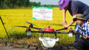
1. Mission Planning and Scene Securing
- Officers select and preprogram flight paths, aiming for 70-80% image overlap to ensure precise photogrammetric results.
- Before deployment, they mark the scene with ground control points—high-contrast markers measured with accurate GPS tools, securing the models to true coordinates.
2. Aerial Data Capture
- The drone surveys the crash site shortly after the incident, taking hundreds of overlapping, geotagged images from various angles.
- Thermal imaging aids in low-light conditions or search and rescue situations.
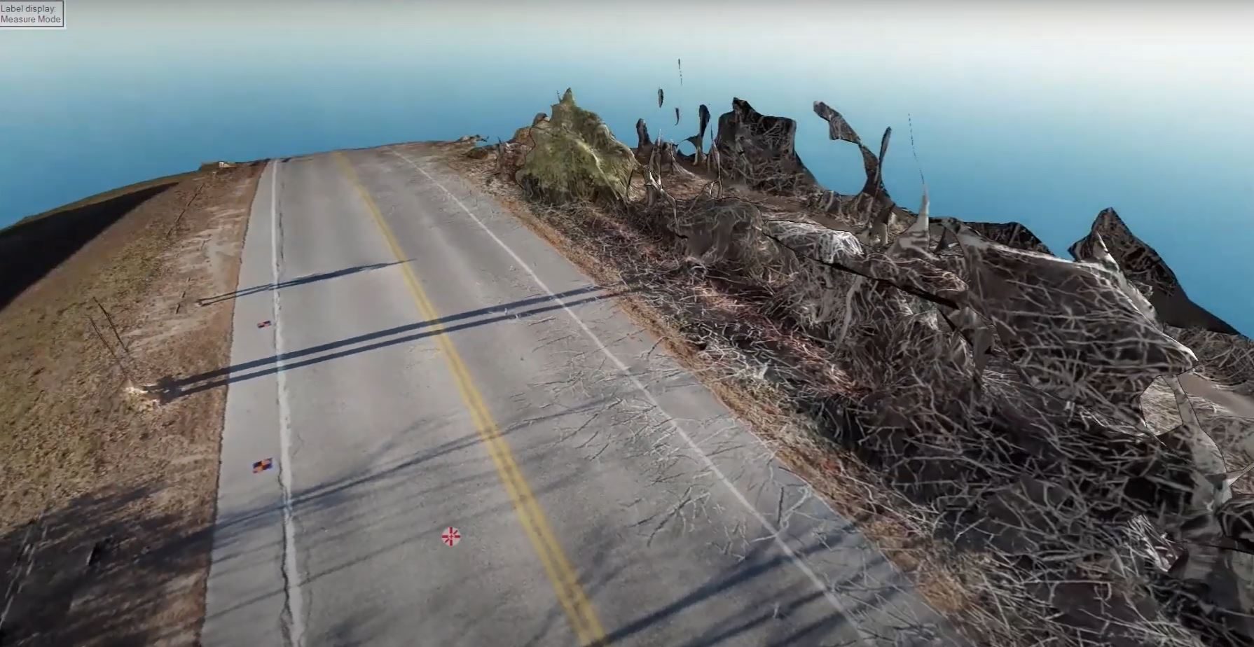
3. Data Processing with Global Mapper Pro®
Back at headquarters—or on-site with advanced laptops—officers import the images into Global Mapper Pro® using the Pixels to Points® tool:
- The software automatically identifies ground control points.
- An accurate orthomosaic is created, combining images into a continuous map.
- A detailed 3D point cloud and mesh model emerges, illustrating elevation, structures, debris, and terrain.
4. Analysis, Measurement, and Reporting
Investigative capabilities include:
- Determining vehicle paths and identifying pavement clues such as skid marks.
- Precisely measuring distances, angles, and locations of vehicles and debris.
- Enhancing reports with annotations and visuals for compelling presentations.
These models are ready for legal settings, providing a permanent, unalterable record of events, supporting future investigations or court needs.
Efficiency in Action: From Hours to Minutes
Drone mapping offers profound efficiency:
- Traditional method: Hours spent on-site, extensive road closures, and immense paperwork follow-up.
- Modern approach (Windham PD): Minutes for data collection, and rapid 3D modeling accomplished in 30–45 minutes due to advanced software.
This accelerates:
- Scene clearance and traffic flow restoration, reducing delays and secondary accident risks.
- Swift investigative workflows, crucial for timely evidence submission to judicial or insurance entities.
The Broader Impact: Safety, Accuracy, and Trust
Officer and Community Safety
Drone use minimizes officer exposure to crash site dangers, significantly lowering secondary incident risks.
Accuracy and Objectivity
Digital reconstructions offer precision, preserving crucial details like tire marks and debris positions, enhancing evidentiary quality in courts.
Cost-Effectiveness
Despite initial expenses, drones cut labor hours, road closures, and potential legal costs, proving economically beneficial over time.
Public Trust
When communities see police employing cutting-edge, transparent technology, it fosters trust in investigative procedures and law enforcement professionalism.
Beyond Crashes: Expanding Law Enforcement’s Drone Toolkit
Aside from reconstructing crash scenes, Windham’s officers leverage drones for:
- Search and rescue: Finding missing individuals using drones with thermal capabilities.
- Tactical operations: Providing real-time insights during critical incidents.
- Crime scene documentation: Detailed mapping of extensive scenes for comprehensive forensic analysis.
Real-Life Example: A Department’s Success Story
Detective Eugene Gallant and Captain Jason Burke of Windham PD highlight how their drone-driven process enhances the speed, safety, and accuracy of investigations. Operating three drones equipped for mapping and thermal functions, they use Global Mapper Pro® for integrated processing and analysis.
A highlighted case involved a complex vehicle accident on a major road, where rapid drone deployment enabled 3D reconstruction that was key in court, aiding in achieving a just outcome based on clear, objective evidence. This approach drew commendation for the clarity of the digital documentation and was appreciated by the public for the swift reopening of a vital traffic route.
Expert Tips for Departments Considering Drone Mapping
- Invest in Training: Effective operators are crucial for the smart use of advanced software.
- Start Simple: Basic drones and mapping tools can offer substantial benefits before full-scale deployment.
- Comply with Regulations: Ensure certification and adherence to FAA and local regulations for drone operations.
- Document Thoroughly: Maintain extensive records of imagery and processing for future court use.
The Human Side: Culture, Memes, and the Future
Drones have become part of policing culture, often humorously referenced as “mini-helicopter air forces.” They reflect an advanced, problem-solving era that influences both officer tactics and public perceptions. The Windham team’s innovative spirit in leveraging technology inspires pride and engagement within their community, setting a new standard for others to emulate.
Conclusion: Building Trust and Raising Standards
As highlighted in the Blue Marble Geographics study, drone mapping is fundamentally recasting police crash investigations. Offering speed, precision, safety, and transparency, it impacts not only on-site operations but extends to courtroom settings and community trust. As more departments adopt this technology, drone mapping is poised to establish new norms in forensic investigations for law enforcement.
For agencies and the communities they serve, the outcome remains clear: enhanced results, reinforced trust, and a more effective approach to justice.
*For further insights into starting or refining a drone mapping initiative, many resources, such as Blue Marble Geographics’ training tools and podcasts, are accessible to support public safety advancements.*