Drones in Disaster: Why Coordination Saves Lives
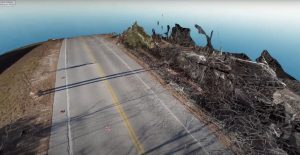
Imagine a scenario where a hurricane devastates a city, flooding roads and toppling power lines. In the chaos, drones hover above, tirelessly searching for survivors, mapping destruction, and providing a crucial link for rescue operations. This is not science fiction; it’s today’s reality in disaster response—where the key to turning potential into life-saving action is coordination.
The New First Responder: How Drones Revolutionize Disaster Relief
Over the past few years, drones, or unmanned aerial vehicles (UAVs), have dramatically transformed disaster response. Here are their significant contributions:
- Rapid deployment: Navigating obstructed roads or hazardous terrain swiftly, reducing emergency response times.
- Aerial imagery and live video: Offering real-time assessments that give teams a comprehensive view of disasters with unparalleled speed and clarity.
- Sensor-equipped reconnaissance: Featuring thermal cameras and gas detectors, drones provide critical situational awareness without endangering human lives.
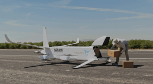
- Supply delivery: When roads are inaccessible, drones deliver water, medicine, and communications equipment directly to the affected.
A compelling case in point: During the 2015 Nepal earthquake, drones were deployed by international teams to locate survivors and assess infrastructure despite difficult ground conditions, resulting in faster rescues and saved lives.
Ten Ways Drones Make Disaster Response Better
Drones are indispensable for emergency services globally for reasons such as:
- Quick Assessment: Quickly obtain overviews of damage for smart, swift responses.
- Safety First: Minimize human risk by gathering data from dangerous areas remotely.
- Cost-Efficient: A cheaper alternative to helicopters or planes, allowing funds allocation elsewhere.
- Versatile Imagery: Capable of capturing high-resolution and night-vision images.
- Access Remote Areas: Reach survivors in hard-to-access locations like mountains and forests.
- Real-Time Feedback: Stream live feeds to command centers for prompt decision-making.
- Long Operation Hours: Extended flight times to monitor ongoing threats.
- Enhanced Communication: Relaying and restoring communication in blackout zones.
- Environmental Analysis: Detect secondary threats such as gas leaks or landslides.
- Supply Delivery: Speedily deliver essentials to isolated communities.
The Coordination Factor: Why Tech Alone Isn’t Enough
Drones unleash their full life-saving potential only when human coordination occurs. As emphasized during the Energy Drones + Robotics Summit, effective disaster drone operations require seamless communication and collaboration among:
- Federal, state, and local emergency agencies
- Private sector volunteers and drone companies
- Amateur drone pilots and the general public
Aaron Fritch, a Captain at the Texas Department of Public Safety, expressed it clearly: “We can have 10 agencies respond to a disaster, and if they’re unified on the same software platform, the type of drone doesn’t matter.” This unified platform ensures all responders coordinate efficiently, reducing collisions and confusion.
Real-World Coordination: The “No Kings” Protests
During significant public events such as the “No Kings” protests, drones were utilized by multiple agencies to safeguard public safety and monitor crowds. A central software system enabled effective tracking and prevented chaos amidst dense aerial activity.
The Regulatory and Human Challenge
Top-tier technology falters if coordination fails. Therefore, experts recommend:
- Adhering to FAA regulations and local “air boss” instructions during disasters.
- Employing unified digital platforms for flight management and data sharing.
- Encouraging communication between professionals and volunteers to minimize airspace conflicts.
- Educating hobbyists and the public about emergency no-fly zones—to ensure rescue missions aren’t hindered, albeit unintentionally.
There’s a strong advocacy for faster emergency flight approvals as swift deployments significantly improve survival chances according to research by the American Red Cross.
Case Study: Drones in the Wake of Disaster
- Fukushima Daiichi Nuclear Disaster (2011): With radiation levels prohibitive for humans, drones delivered critical imagery and risk assessments.
- Nepal Earthquake (2015): Drones efficiently mapped devastated areas and assisted in locating survivors swiftly.
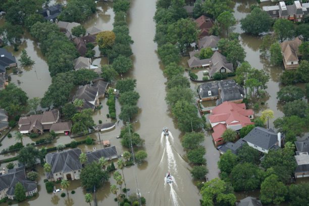
- Global Hurricanes and Floods: Drones frequently deliver essentials and temporary communication setups to stranded groups.
These cases highlight that drones enhance responders’ reach, speed, and safety—predicated on effective coordination.
Building a Coordinated Drone Response: Lessons for Today
If you lead, volunteer for, or support disaster relief efforts, consider these best practices for heightened impact:
- Standardized Software Platforms: Integrate compatible systems for drone management and data sharing.
- Joint Training: Conduct regular exercises for pilots and teams to master collaborative efforts during high-pressure situations.
- Centralized Command: Define roles clearly, particularly “air boss” duties in managing drone activities.
- Community Engagement: Partner with reputed operators and train local hobbyists in emergency protocols—maintaining safety as a priority.
- Flexible Authorization: Push for expedited FAA or local emergency drone flights.
- Privacy and Ethics: Maintain clear data security and privacy guidelines during aerial imaging in disaster contexts.
The Human Side: Bringing Teams Together
Each drone operation relies on human collaboration—a synergy of firefighting instincts, technical expertise, and heroism. The most successful teams exhibit strong:
- Technical skill: Piloting in adverse conditions, conducting real-time mapping, and operating sensors.
- Teamwork: Clear communication, data sharing, and mutual trust.
- Cultural sensitivity: Honoring local customs, necessities, and priorities—especially when combining international aid with local initiatives.
Red Cross and NGO missions are stellar examples of international and local volunteer alliances maximizing drone capabilities.
What’s Next? The Future of Drones in Disaster
Trends likely to advance disaster response encompass:
- Swarm Drones: Coordinated fleets for extensive search and mapping tasks.
- Artificial Intelligence: Advanced pattern recognition detecting survivors among debris.
- Advanced Payloads: Drones carrying defibrillators, mini power stations, or communication satellites.
- Integration with IoT: Linking drones with ground sensors, satellites, and smart infrastructure for comprehensive management.
Nevertheless, the core takeaway continues to be: Human coordination amplifies technological capabilities.
Final Thought: Movies, Memes, and the Magic of Cooperation
Ever recall watching disaster films like “San Andreas” or “The Day After Tomorrow,” wondering at the protagonists’ seamless coordination with sophisticated tech? Echoing those fictions, modern drones harness this capability. Yet, without teamwork, technology can falter—as every gamer might realize attempting drone maneuvers in “Watch Dogs 2” or “Call of Duty” without a strategy.
Drones are more than mere flying machines; they represent the potency of human empathy and ingenuity as force multipliers. Through united efforts—across agencies, borders, and cultures—we unlock their ultimate prowess: the ability to save more lives, swiftly.
Are you prepared for this future? Whether you’re a responder, drone enthusiast, or decision-maker, remember: Coordination is the decisive factor between chaos and hope—and the catalyst for rewriting disaster relief principles.
*This article is informed by insights from the DroneLife Energy Drones + Robotics Conference, case studies from global disaster contexts, and wisdom of responders worldwide.*