DJI Drones Reveal How Melting Glaciers Are Rewriting Norway
Introduction: When Tech Meets Ice – Norway’s Glaciers Under the Drone’s Eye
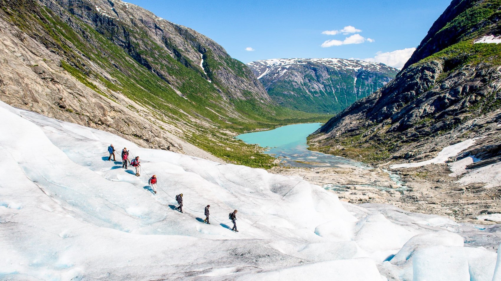
Picture this: a fleet of DJI Mavic drones gliding through the cold Norwegian sky, navigating between peaks and the blue ice of the Nigardsbreen glacier. This is not a sci-fi film scene but a real event in 2025 as drones help unlock the mysteries of a rapidly warming Earth. In Norway, where glaciers serve as both historical heritage and contemporary warnings, DJI drones are crucial for research and environmental adaptation efforts.
This guide explores how drone technology, incredible imagery, and environmental science are reshaping the narrative of Norway’s melting glaciers. Gain insights, remarkable facts, legal advice, and a hint of Norwegian adventure, suitable for scientists, drone enthusiasts, or climate explorers.
Section 1: The Big Picture – Why Norway’s Melting Glaciers Matter
- Norway boasts some of Europe’s largest glaciers, like Jostedalsbreen and its notable outflow, Nigardsbreen. These icy formations act as time capsules, preserving the history of past climates within each layered sheet.
- Climate warming has increased glacier melting, creating new lakes, altering rivers, and modifying maps. Fjords and valleys today were once carved by these glaciers thousands of years ago, and they are now visibly evolving.
- The implications exceed their scenic appeal:
- Rising sea levels pose a threat to coastal areas globally.
- New landforms emerge, transforming landscapes as ice retreats.
- Local weather patterns may shift as melting glaciers change wind, precipitation, and heatwaves in the Nordics.
*Fun fact:* Norway’s glaciers serve as “canaries in the coal mine” of climate science, signaling imminent global changes.
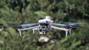
Section 2: DJI Drones – Not Just for Pretty Pictures
- DJI drones, including the Mavic series and others, provide more than just visuals. In Norway, they prove essential for:
- High-resolution mapping of glacier surfaces, discerning minute changes invisible from land.
- Thermal imaging and multispectral sensors expose thinnest ice areas or hidden meltwater routes.
- Live data relay allows remote monitoring from hundreds of kilometers away.
*Case in point:* A Norwegian study employed DJI drones to survey Nigardsbreen, capturing stunning 4K visuals and creating detailed 3D models of glacier changes, crucial for flood predictions and ecosystem insights.
Section 3: Amazing Discoveries – What the Drones Showed Us
- Hidden Lakes & Sudden Floods: Newly formed lakes might burst unexpectedly, causing flash floods. Drone captures provide crucial alerts for those downstream.
- Changing Landscapes: Drones have recorded rockfalls and landslides as glacial support decreases—showing how retreating glaciers reshape terrains.
- Wildlife Exploration: With emerging habitats, animals adjust. Drones observed reindeer herds and birds migrating to freshly revealed grounds, offering insights into adaptation strategies.
*Human factor:* For many Norwegians, drone footage offers more than data—it’s a tangible reminder of their rapidly changing environment.
Section 4: Behind the Scenes – How the Drone Teams Work
Each drone shot involves a multidisciplinary team:
- Climate scientists design flight paths focused on safety and precision.
- Drone pilots overcome challenges like wind, rain, and cold, using their expertise to navigate.
- Data analysts process numerous images into valuable maps, time-lapse videos, and models.
*Pro tip for aspiring pilots:* The DJI Air 3 is favored in Norway for its solid design, 35-minute battery longevity, and tolerance for light rain.
Section 5: Legal & Safety Tips – Flying Drones in Norway
To explore Norway’s glacial wonders upwards, adhere to these guidelines:
- Drones are permitted for tourists and researchers if following Civil Aviation Authority regulations.
- Key rules: Fly below 120 meters, maintain 5 km distance from airfields, keep visual line of sight, respect privacy, and know local no-fly zones.
- Battery transport: Check airline rules for drone batteries.
*Expert tip:* Keep a copy of regulations handy in Norwegian or English to share with authorities or curious locals.
Section 6: Drones and Climate Science – The Bigger Purpose
Drones are revolutionizing climate research by democratizing it:
- Fieldwork once taking weeks is now reduced to hours by drones.
- Consistent mapping allows scientists to develop detailed models for predicting glacier changes and planning for climate impacts.
- Drone footage is vital in raising awareness and advocating for urgent climate actions, turning complex data into a compelling visual message.
*Stat box:* Drone surveys can cut costs by 80% over traditional methods while improving data resolution.
Section 7: The Human Impact – Stories from Norway
- Reimagining Tourism: Local tours now blend climate education with glacier tours, featuring past and present drone visuals.
- Creative Initiatives: Artists harness drones to share emotional narratives of changing landscapes.
- Student Engagement: Educational programs encourage students to monitor glaciers, connecting science education with environmental stewardship.
Section 8: The Future of DJI Drones in Norway
DJI continues to evolve, with 2025 introducing new models like the Mavic 4 Pro and Mini 5 Pro:
- Autonomous drone stations promise uninterrupted glacier surveillance, even during winter darkness.
- AI-driven analysis will recognize hazardous cracks and wildlife formations automatically.
Section 9: How You Can Get Involved
- Aspiring Pilots: Enroll in drone courses to begin piloting.
- Activists & Scientists: Share drone insights to influence policymakers.
- Travelers: Fly responsibly and inspire others through your imagery.
*Join the movement:* Organizations like the Drone Advocacy Alliance work to protect drone usage rights globally.
Section 10: Beyond Norway – Drones in Global Conservation
Norway is just the start. Globally, DJI drones aid in:
- Monitoring polar wildlife.
- Mapping endangered forests.
- Assessing ocean health.
*Cool fact:* Remote teams now survey Arctic areas via drones, enhancing safety and reducing costs significantly.
Conclusion: Why This Story Matters
More than a local issue, Norway’s melting glaciers signify a global call for awareness and action. DJI drones bring visibility to this environmental change, offering vital data and stories that inspire connection and action worldwide.