Everything You Need to Know About SPH Engineering’s Updated Mission Planning Software: The 2025 UgCS Guide
Drones have evolved from science fiction gadgets to integral tools transforming industries such as filmmaking, mapping, precision farming, and infrastructure assessment. Supporting these aerial wonders is the unsung hero: drone mission planning software. In 2025, SPH Engineering’s UgCS is setting a new standard.
Whether you oversee a drone business, manage field operations, or are an enthusiastic UAV hobbyist, getting acquainted with the latest UgCS updates will enhance your mission’s intelligence, safety, and—even—enjoyment. This guide delves into the crucial updates, their significance, and how UgCS can revolutionize your drone ventures.
Why Mission Planning Software Matters (And Why UgCS Leads the Pack)
Envision preparing for a drone mission relying solely on paper maps, a simple calculator, and hope. That era is obsolete. Modern mission planning tools like UgCS:
- Automate complex flights—minimizing manual workload.
- Enhance safety—by considering local topography, restricted areas, and equipment limits.
- Provide better data—through precise altitude and camera regulation.
- Enable repeatability—crucial for observing, surveying, and scientific studies.
SPH Engineering’s UgCS (Universal Ground Control Software) is popular among professionals globally. Its appeal? Not only does it match industry pace; it anticipates needs, inspired by authentic feedback from operators operating everywhere—from urban rooftops to isolated jungles.
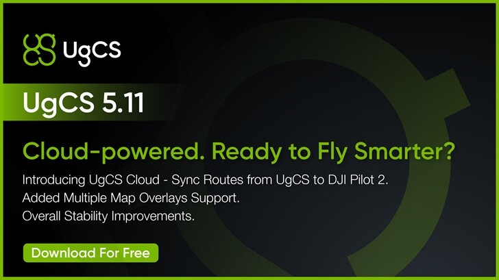
What’s New in UgCS 2025: Key Features & Improvements
1. Elevation Data Accuracy—Now Even Smarter
Terrain-following is essential for secure, effective flights—especially in challenging terrains like mountains, mines, or dense forests. The recent UgCS release offers:
- Enhanced elevation data accuracy, defaulting to USGS 1/3 Arc Second in the U.S. This upgrade moves from a 30-meter to a 10-meter data point interval—critical for photogrammetry, LiDAR, and BVLOS missions.
- Improved route calculations in difficult settings, letting surveyors and inspectors trust their drones to mimic the earth’s form—eliminating surprises, ensuring results.
2. Explicit Flight Altitude Settings
Earlier, photogrammetry and corridor mapping missions in UgCS required operators to rely on ground sample distance (GSD)—useful for some, but less clear for others. Now you can:
- Set flight altitude directly, in line with industry standards for transparency and management.
- Easily view image resolution and flight elevation—crucial for adhering to regulations and scientific consistency.
“Our users asked for more flexibility and clarity regarding flight height in photogrammetry missions. This update delivers that, bringing UgCS in line with the standards professional pilots expect.” — Kristaps Brass, UgCS Product Owner
3. User Experience Upgrades
Mission planning should be instinctive—even under stress. UgCS responded:
- Noticeable Export Route Button: No more searching—it’s conveniently placed, enhancing workflow for everyone, particularly in UgCS Open.
- Top Drone Models Highlighted: The five most favored platforms are prioritized, streamlining new route setups—ideal for fleet managers handling varied hardware.
- Multi-lens Camera Functionality: While planning photogrammetry, UgCS defaults to the wide camera, minimizing manual adjustments and errors.
- Enhanced Visual Inspection Tools: A new Circle tool makes planning orbits around points of interest effortless—perfect for tower, chimney, or turbine inspections.
4. New Drone & Payload Support
UgCS is known for its “universal” compatibility. The latest update adds:
- Support for DJI M3D and M3TD—cutting-edge platforms gained popularity among enterprise users.
- Continued integrations for numerous payloads, from multispectral sensors to thermal cameras, allowing customization for any task.
5. No-Fly Zone (NFZ) Setup Simplified
On fresh installations, NFZs are now disabled by default—ensuring swift independent operation (with options to enforce airspace restrictions if necessary).
The Real-World Edge: UgCS in Action
Wildfire Response and Disaster Relief
Time is critical. UgCS enables rescue teams to preload maps and strategize offline, modifying routes in real-time even offline. Terrain-following assures drones navigate securely over varied landscapes—transmitting thermal images and crucial data where needed most.
Mining & Infrastructure
In expansive pits and isolated mining locales, UgCS’s offline planning and precise elevation models maintain surveyor safety and compliance. Pilots can map routes or inspect slope stability without a data connection.
Regulatory Turbulence: The DJI Ban and Beyond
As fleet dynamics change overnight due to regulations and rumors, UgCS’s multi-platform design allows teams to substitute non-DJI drones and modify existing flight plans with minimal retraining.
Heritage and Façade Scanning
UgCS’s automatic vertical scan tool helps operators build 3D models of structures or heritage sites for restoration, insurance, or tourism. Just specify the area and overlap; the software determines the optimal route—additionally allowing 3D objects and custom terrain data to be imported when needed.
Offline Mission Planning: Why It Matters in 2025
Many crucial missions—be it search and rescue, agriculture, or infrastructure—occur far from cellular networks. UgCS’s robust offline capabilities ensure you can:
- Preload maps and elevation data beforehand
- Revise missions on-site without internet
- Execute complex, terrain-sensitive routes with assurance anywhere
This capability is not merely advantageous. In mining, for example, it is vital.
Human-Driven Innovation: The SPH Engineering Approach
UgCS isn’t developed in isolation. Feedback loops—from users, webinars, case studies, and global community forums—drive its progression. The roadmap for 2024 and 2025 includes:
- “User cases inform every new feature.” User input guides priorities, whether inspecting power lines or agricultural mapping.
- Monthly expert guides and tutorials—available on YouTube or their knowledge base for practical, scenario-focused tutorials.
- Community involvement is prioritized: Facebook groups, polls, and even challenges where users can propose or experience new features.
Success Story: Global Adoption
UgCS empowers fleets worldwide—from small startups to large engineering firms addressing everything from urban infrastructure assessments to environmental conservation projects. Clients share stories of significantly reduced survey time, enhanced safety records, and delivering data that impresses their clientele.
What About Cost?
UgCS provides desktop-based lifetime licenses (e.g., $600 or $2,000 for full editions) with flexible short-term choices—ideal for both occasional contractors and corporate teams. It supports most leading UAVs (including DJI and MAVLink-based models), with continuous hardware compatibility maintained as the drone market evolves.
The Future: What’s Next for UgCS?
Looking toward late 2025 and beyond, SPH Engineering focuses on:
- Trajectory smoothing for even greater precision in flight paths.
- Expanded payload integrations, incorporating advanced sensors.
- New learning resources ensuring all users, from beginners to experts, maximize utilization.
- Community-led feature creation—recognizing that each drone operation is unique.
Expert Tips for Getting the Most from UgCS
- Utilize offline planning capabilities: Load maps when working off-grid.
- Leverage explicit altitude settings: For repeatable, compliance-oriented mapping.
- Explore new Circle and Visual Inspection tools: Ideal for inspecting circular structures—like tanks, silos, or towers.
- Default camera settings reduce errors: Less manual input results in fewer mistakes.
- Share feedback: UgCS developers actively incorporate user suggestions—your insights could shape forthcoming updates.
A Little Humor: What If Drones Ran the World?
If drone mission planning was guided by memes, you’d hear this:
*“Fly straight, photograph spectacularly, evade obstacles. Don’t miss—snacks for the pilot.”*
Gratefully, UgCS is overseen by skilled engineers, not meme enthusiasts (unless you count the office coffee machine).
Conclusion: Why UgCS Remains the Professional’s Choice
In 2025, drone operators demand more than mere waypoints—they require intelligence, adaptability, and dependability. SPH Engineering’s UgCS guarantees:
- Superior elevation and terrain-following
- User-friendly, pilot-centric interface
- Direct altitude control
- Extensive hardware compatibility
- Offline mission planning for field robustness
- Ongoing expert support and an active community
Whether mapping vast expanses or inspecting structures, UgCS evolves with you—assisting you in adapting, expanding, and thriving no matter where the drone landscape leads.
Ready to explore the new UgCS? Download the latest version from SPH Engineering and experience advanced mission planning first-hand.
Want real user stories or tailored guidance? Connect with the UgCS community—where every pilot learns and teaches. As SPH echoes: Smart flights, improved data, and more fruitful missions. Here’s to reaching new heights in your drone ventures!