How SimActive’s Correlator3D Transforms Large-Scale Drone Data Processing for SurvTech: An In-Depth Guide
Introduction: The Big Data Challenge in Drone Mapping
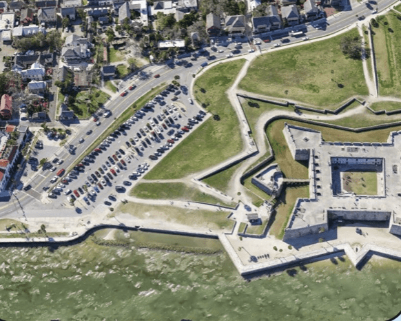
When drone mapping is mentioned, images of stunning aerial photographs or impressive 3D city models from films might come to mind. In real-world applications, teams like SurvTech Solutions employ drone fleets to gather terabytes of images for various large-scale projects, including infrastructure and environmental surveys. The challenge is that without efficient processing, this vast, high-resolution data remains non-functional. This is where SimActive’s Correlator3D plays a crucial role. It has revolutionized SurvTech’s operations, enabling them to transform extensive drone image collections into practical mappings and 3D models efficiently and rapidly.
What Is Correlator3D—and Why Is It A Game-Changer?
Correlator3D is a state-of-the-art photogrammetry software suite designed to handle imagery from drones, aircraft, and satellites, creating precise geospatial products. It performs critical functions such as aerial triangulation for accurate 3D geometry, creating DSMs and DTMs, generating point clouds and 3D models, seamless orthomosaic creation, vectorized 3D feature extraction, and integrating LiDAR data for enhanced mapping workflows.
Unlike many solutions that act as black boxes, Correlator3D allows users full control over each step, supporting a wide range of sensors from consumer drones to high-end satellite imagery and LiDAR payloads.
The SurvTech Story: Fast, Accurate Results at Scale
SurvTech Solutions, a leader in geospatial services, processes massive drone datasets from surveys spanning thousands of acres. Traditionally, this task could take days or weeks without efficient software. Correlator3D significantly cuts down processing time, turning day-long tasks into hours through GPU acceleration and multi-core CPU support. It handles vast datasets in a single workflow and maintains consistent, survey-grade accuracy thanks to detailed QA/QC tools assisting compliance and customer trust.
How Does Correlator3D Achieve Such Speed and Scale?
The innovation behind Correlator3D comes from patented algorithms and a design optimized for hardware. It leverages GPU acceleration and multi-core CPU utilization, often processing tasks up to ten times faster than its competitors. It also supports distributed processing, allowing workloads to be distributed across multiple PCs, and there’s no restriction on image volume. This makes Correlator3D particularly suitable for processing enterprise-scale jobs.
An example: a survey with 2,500 images, each 20 MP, can be fully processed in under 45 minutes on a regular PC.
Expert Tips for Maximizing Correlator3D with Your Drone Data
- Leverage Full Workflow Control: Customize processing parameters for specific project needs, whether seeking speed, high accuracy, or the best appearance.
- Integrate LiDAR and Photogrammetry: The software supports joint registration of imagery with LiDAR, optimizing workflows for various terrains.
- Use Advanced Editing Tools: Refine GCPs, tie points, and DEMs in one interface for effective georeferencing and error resolution.
- Automate for Production: Harness scripting capabilities to automate workflows, save time, and minimize errors.
- Don’t Worry About Hardware: While performance improves with powerful PCs, Correlator3D also runs effectively on standard Windows desktops.
SurvTech advises: “Correlator3D allows us to manage significant image batches without splitting them, which is essential for corridor mapping projects.”
Photogrammetry vs. LiDAR in Correlator3D: Finding Your Best Fit
| Approach | Best For | Correlator3D Advantages |
|---|---|---|
| Photogrammetry | Urban, construction, agriculture | High-res color, quick processing |
| LiDAR | Forests, infrastructure, power lines | Vegetation penetration, detailed features |
| Hybrid (Both) | Large, complex projects requiring high mapping accuracy | Registration, colorization, and quality assurance |
Dr. Philippe Simard from SimActive states, “Project requirements guide the choice of tool. Photogrammetry excels in visual details, while LiDAR is best in densely forested areas. With Correlator3D, you’re free to combine both approaches effectively.”
Why Survey Firms, Governments, and Enterprises Prefer Correlator3D
- Proven Technology: Adopted widely by leading mapping firms and government agencies.
- Outstanding Support: Users value SimActive’s technical support and rapid response.
- Flexible Licensing: Regular software updates introduce advanced features, keeping clients at the forefront.
- Universal Sensor Compatibility: Compatible with all major drone, camera, and LiDAR systems.
Real-World Example: SurvTech’s Corridor Mapping Success
SurvTech recently completed a corridor mapping project, managing hundreds of kilometers for a utility. With Correlator3D, they processed over 10,000 drone images and multiple LiDAR collections swiftly, delivering accurate models ahead of schedule and securing future contracts through their efficiency and quality delivery.
The Project Manager at SurvTech claims: “Correlator3D empowers us to exceed in meeting timelines and data quality expectations.”
Looking Ahead: The Future of Large-Scale Drone Mapping
As the use of drones intensifies across various sectors, from construction and agriculture to public safety, the demand for scalable, dependable processing tools surges. Correlator3D is at the forefront, supporting rapid, precise, and cost-effective mappings. SimActive is committed to enhancing its capabilities further, introducing AI integrations, real-time data analytics, and more automation.
Who Should Consider Correlator3D?
- Surveying and Mapping Firms: For efficient data processing.
- Construction Companies: Demanding accurate site models.
- Utilities: Managing infrastructural corridors and assets.
- Government Agencies: For urban planning and environmental work.
- Drone Professionals: Interested in transitioning to smarter and scaled efficiencies.
Summary of Key Benefits
- 10x Faster Processing: With GPU/CPU enhancement.
- Unlimited Image Processing: No need for dataset partitioning.
- Survey-Grade Accuracy: With complete audit capabilities.
- Workflow Control & Automation: To optimize operations.
- Exceptional Support & Upgrades: Regular updates keep users ahead.
- Seamless Sensor Integration: Compatible with LiDAR and other sensors.
Final Thoughts: Enhance Drone Data Utility
If slow rendering and complexities in batch processing have been challenges, exploring Correlator3D is worthwhile. For firms like SurvTech, this software is a competitive edge, a time-management tool, and a growth pillar. The ongoing expansion in drone mapping demands such robust solutions. Dive into the capabilities of Correlator3D for a future built on proficiency and foresight.