UAV Navigation–Grupo Oesía: Cutting-Edge Flight Control for Firefighter Drones
With wildfires becoming increasingly common and severe, threatening forests, homes, and livelihoods, the field of unmanned aviation is stepping up to the challenge. One notable contribution comes from UAV Navigation–Grupo Oesía, a Spanish leader in technology, which has placed its advanced flight control system at the forefront of firefighting using the French-created DRIADE UAV. This article delves into how this collaboration is transforming aerial firefighting and its implications for the future of emergency drone missions.
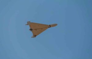
DRIADE: A New Breed in Firefighting UAVs
The DRIADE is a robust, fixed-wing unmanned platform developed by SE Aviation in France. With a significant maximum take-off weight of 820 kg, DRIADE transcends ordinary drone tasks, designed for challenging missions like aerial reconnaissance and wildfire suppression. In this realm, minimizing errors and implementing sophisticated control systems is mission-critical.
Flight Control Core to the Mission
UAV Navigation–Grupo Oesía leverages more than twenty years of expertise in Guidance, Navigation, and Control (GNC) solutions for unmanned aircraft, amassing over 60,000 flight hours in complex terrains. For DRIADE, they provided the adaptable VECTOR-600 autopilot, designed for:
- Both autonomous and manual flight operations
- Redundant systems for optimal safety and reliability
- Precision in navigating high-risk environments
- Compatibility with advanced payloads (cameras, sensors, release systems)
Optionally Piloted Vehicle (OPV) Framework
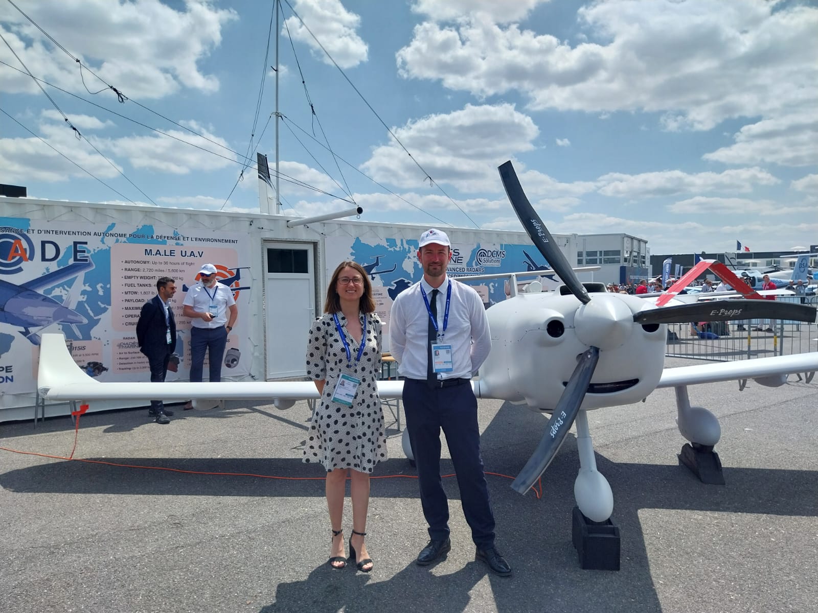
A fascinating element of the project is the Optionally Piloted Vehicle (OPV) architecture. In its initial implementation, UAV Navigation–Grupo Oesía incorporated VECTOR-600 into the manned MCR 4S aircraft from SE Aviation. This dual-mode system allows the same aircraft to be either human-piloted or remotely operated as an unmanned vehicle, ensuring:
- Safe, risk-free testing
- Gradual transition from manned to unmanned operations
- Operation in hazardous environments without risking human life
The Importance of Advanced Flight Control in Wildfires
Firefighting missions require significantly more than simple point-to-point flying. A modern UAV for wildfire defense necessitates:
- Stable flights amidst turbulence, smoke, and poor visibility
- Automated mission implementation (search patterns, designated drop areas)
- Real-time, precise data transmission to ground teams
- Integrated payload control (such as thermal cameras and fire retardant release)
UAV Navigation–Grupo Oesía’s VECTOR-600 fulfills these demands by integrating:
Advanced Guidance & Automation
- Automated flight plans: Operators can pre-configure complex search grids, aircraft flyovers, perimeter sweeps, and optimized area surveillance to map and monitor fires.
- Waypoint-triggered functions: Missions can include precise, automatic activation of equipment at specific coordinates (e.g., deploying fire retardant at a designated GPS point).
- Dynamic re-tasking: DRIADE can change course during a mission based on real-time data from field sensors or crew feedback.
Real-Time Data and Visualization
- 3D Flight Visualization: Operators monitor aircraft status and terrain live, vital for maintaining awareness in smoky, unpredictable situations.
- Complete camera payload integration: Enables automatic or manual tracking of fire hotspots, essential for immediate response and post-mission evaluation.
- Live telemetry and fail-safe redundancy: Multiple communication and control channels ensure connectivity—even in challenging settings.
Safety, Redundancy, and Compliance
- Redundant critical systems: The new DRIADE architecture includes multiple backups, complying with stringent aviation safety regulations.
- Manned and unmanned flight transition: This increases operational adaptability and streamlines certification, facilitating safe demonstrations and tests.
Practical Example: Firefighting UAVs in Action
Consider the technology in practice: in Spain, the Military Emergency Unit (UME) uses drone platforms equipped with similar GNC technology to oversee and manage wildfires. During a significant forest fire, drones with geo-pointing cameras delivered live video, surveilled hotspots autonomously, and communicated data for effective ground crew deployment. These drones even executed automatic firefighting payload drops, activated by pre-calibrated waypoints, enhancing response time and lowering risks to human pilots.
VECTOR-600 Autopilot: Key Features
The VECTOR-600 is distinguished by:
- Adaptive flight algorithms: Manages turbulence, complex flight dynamics, and rapid environmental shifts.
- Sensor fusion: Combines data from GPS, inertial sensors, cameras, and environmental detectors for robust navigation and control.
- Easily integrates: Compatible with various types of airframes, from fixed-wing to rotary UAVs, and multiple ground control stations.
UAV Navigation–Grupo Oesía: Reliable Expertise
Since its inception in 2004, UAV Navigation–Grupo Oesía has emerged as a European frontrunner in flight control for both civilian and military UAVs, offering advanced solutions for:
- Fixed-wing and rotary UAVs
- Manned-unmanned teaming (MUT) and swarm operations
- Critical missions: search and rescue, disaster response, border protection, and more
With a record of over 60,000 successful flight hours, the company has fostered a reputation for:
- Customization: Adapting systems to the specific mission requirements of each client.
- Dependability: Certified, field-tested hardware and software designed for harsh conditions.
- Innovation: Ongoing R&D includes AI integration, machine learning, and swarm control advancements for future autonomous UAV operations.
The Human Element: Collaboration and Dedication
The triumph of projects such as DRIADE is about more than just hardware and code—it relies on human effort. Engineers from UAV Navigation–Grupo Oesía and SE Aviation cooperate closely to ensure the system—in aspects from mission planning to in-flight safety—is meticulously fine-tuned. As Laura García-Junceda, project manager at UAV Navigation-Grupo Oesía, states:
This collaboration reinforces our commitment to delivering advanced, modular, and reliable flight control solutions tailored to each customer’s mission needs, while incorporating the necessary levels of redundancy and safety to support high operational standards.
Impact on Firefighting Operations?
Through the deployment of sophisticated UAVs like DRIADE:
- Firefighters can evaluate risky areas in real-time without placing personnel in danger.
- Night surveillance and mapping become feasible, aiding in containment efforts and post-fire evaluations.
- Payload drops (such as water, fire retardant, and sensors) can be executed with precise accuracy.
- Fast, adaptable response: UAVs are ready for immediate deployment, unlike helicopters which need more prep time and involve risks to humans.
The foreseeable future may feature UAV fleets (akin to