WingtraRAY: Redefining Aerial Surveying—A Comprehensive Guide to the Drone Breaking Survey Limits
Introduction: The Next Leap in Surveying
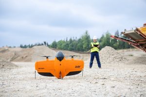
If you’re involved in surveying, mapping, or geospatial data gathering, the mention of WingtraRAY should excite you. Released by Swiss drone innovator Wingtra in July 2025, this state-of-the-art VTOL (Vertical Take-Off and Landing) drone targets the most persistent issues in aerial surveying. Tailored for extensive mining areas, urban infrastructure, or scenarios needing rapid responses, WingtraRAY stands as a comprehensive tool for professionals requiring accuracy, efficiency, and cutting-edge safety.
This guide delves into all aspects of WingtraRAY: its specifications, innovative features, workflow enhancements, practical impact, and its significance for surveyors, businesses, and drone aficionados.
Why Surveyors Needed a New Solution
Though drones have revolutionized mapping, they’re not without challenges like:
- Complex workflows and software issues
- Repeated site visits owing to incomplete data
- Regulatory hurdles about flying over populated or urban zones
- Bulky payload changes and slow setup times
- Anxiety over data sufficiency
Surveyors and engineers desired a drone offering millimeter-level accuracy, swift handling of large sites, and compliance—even for complex operations above populated areas.
Enter: WingtraRAY.
Meet WingtraRAY: Born to Break Limits
Wingtra’s latest offering isn’t just an upgrade; it’s a radical redesign:
- NDAA-compliant and GSA-approved (ideal for government and enterprise use)
- Swiss engineering: reliability, precision, and security as its foundation
- Uniquely designed for an effortless, single-platform experience
Key Technical Highlights
| Feature | WingtraRAY Specification/Benefit |
|---|---|
| Flight Time | Up to 59 minutes per flight |
| Area Coverage per Flight | Up to 1,360 acres (550 ha) in a single sortie |
| Speed | 36–49 mph (adaptive to mission needs) |
| Payload Flexibility | 6 hot-swappable, high-precision sensors (including LIDAR, RGB, etc.) |
| Imaging Resolution | Millimeter-level (down to 0.1 in/px or 2.5 mm/px) |
| Absolute Accuracy | Up to 3 cm (using PPK and GCP workflows) |
| Urban Ops and Safety | Parachute, obstacle avoidance, dual telemetry, backup battery |
| Operation Over People | Approved for Category 3 OOP (US)/EASA STS-02 (Europe) |
| Integration | End-to-end workflow via WingtraCLOUD |
| Setup Time | 5 minutes (including swappable sensors and batteries) |
What Makes WingtraRAY Special?
1. Speed and Efficiency: Cover More, Faster
Imagine completing tasks that previously required a full workday in mere hours. With WingtraRAY, you can:
- Map 100 hectares (250 acres) in just 10 minutes
- Gather data from vast sites (up to 1,360 acres) within a single 59-minute flight
- Achieve speeds 10× faster than multirotors and 30× faster than terrestrial surveying
No longer is there a need to wait for multiple flight sessions or site revisits. Setup, fly, and produce CAD/GIS-ready results within hours.
2. Plug-and-Play Payloads: One Drone, Every Job
Future mission requirements are unpredictable, but WingtraRAY is ready with six hot-swappable payloads, adjusting instantly to any task:
- LIDAR for precise digital terrain models
- 61 MP full-frame RGB for photorealistic maps and 3D models
- An INSPECT payload for ultra-high-resolution (2.5 mm/px) inspections, ideal for spotting cracks on airport runways or bridges
Swapping sensors or batteries is quick, with no additional tools needed and no workflow hindrances.
3. Uncompromised Safety, Compliance, and Urban Capability
Operating over urban areas or crowds was once limiting for many drones—WingtraRAY changes that:
- A parachute system: certified for operations above crowds without needing special permissions (Category 3 OOP, C6, EASA STS-02)
- Features such as obstacle avoidance and dual telemetry (radio + LTE) ensure strong situational awareness
- A backup battery and fail-safes guarantee peace of mind
It seamlessly aligns with obligations for sensitive missions, ensuring compliance from the ground up.
4. End-to-End Surveying: Less Hassle, Better Results
From strategy to execution, everything is seamlessly integrated:
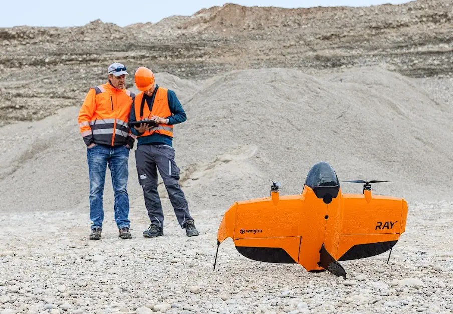
- WingtraGROUND: Facilitates speedy field setup and onsite mission oversight
- WingtraCLOUD: Enables planning, flying, processing, and creating CAD/GIS-ready files without extra conversions or app changes
- The automatic data sync ensures smooth integration of all data and ground control points
Even those with minimal background can fly, process, and produce professional results—all in one streamlined workflow.
5. Security and Scalability for Enterprise and Government
Compliant with NDAA standards, WingtraRAY supports rigorous data encryption and security, making it ideal for industries requiring high degrees of reliability and compliance. Large organizations can confidently scale its deployment.
Real-World Examples and Use Cases
Consider how WingtraRAY excels in real-world scenarios:
- Mining and Quarrying: Weekly mapping of entire operations, observing stockpile and terrain changes without halting workflows or risking surveyor safety
- Urban Infrastructure: Bridge inspection above highways using the INSPECT payload, fully certified for above-population flights
- Disaster Response and Utility Services: Rapidly map flood zones or power grids, providing emergency teams with current data
- Airports & Runways: Spot cracks and surface problems at a striking 2.5 mm/px resolution, making routine maintenance proactive
Wingtra experts reveal that clients are increasingly embracing more projects, trimming turnaround durations, and erasing the stress of incomplete data gathering. One surveyor shared, “I now see results on my phone before finishing my coffee, instead of predicting a return trip tomorrow.”
Expert Tips: Making the Most of WingtraRAY
Here are some pointers to maximize WingtraRAY’s potential:
- Utilize swappable sensors: Ready both LIDAR and high-resolution RGB; adapt to evolving site conditions with no delay
- Prepare missions with WingtraCLOUD: Establish your flight pattern and assess GSD/AGL graphs for perfect coverage before leaving the site
- Employ safety features: Always have the parachute ready for urban operations and OOP tasks—it’s essential for jobs competitors often bypass
- Integrate with existing GIS/CAD workflows: Outputs are platform-ready—simply drag and drop
- Train your team: Although user-friendly, a 30-minute session on mission setup and data processing is a wise investment
Wingtra’s Philosophy and Team
Not just another tech outfit, Wingtra’s Swiss roots infuse their commitment to reliability, diligence, and enduring excellence. The team is a blend of engineers, surveyors, and data experts, many of whom are drone pilots themselves, understanding the pressures of reflying for missing data or chasing compliance documents.
Their collaborative approach involves constant refinement with hands-on insights from surveyors, city planners, and mining engineers globally. Regular WingtraCLOUD updates, prompt support, and a comprehensive service network differentiate them in the drone realm.
“I remember our primary client mapping an expansive quarry in a half-day. The crew dubbed it magic. We just term it Swiss engineering,” Wingtra’s Senior Product Manager quips.
Customer Stories: Changing the Game
- A civil engineering company in the US transitioned to WingtraRAY, seeing project timeframes shrink by 60%. Surveying urban developments quicker, they now secure contracts due to their speed and compliance capabilities.
- A mining firm in Australia notes reduced onsite dangers considerably: “We’re no longer sending teams into hazardous pit areas—the drone completes it in a single flight, offering superior data quality.”
- A European city planning agency overcame “urban no-fly zone” challenges by leveraging WingtraRAY’s OOP certification and integrated parachute system.
The Human Touch—Your Partner, Not Just a Vendor
Wingtra strives to be more than just a vendor, but a true ally for its clients. Whether you’re experienced in surveying, city planning, or new to drone data, their support, onboarding, and continuous learning resources are crafted for your success.
Their engaged user community shares tips, mission layouts, and troubleshooting guidance. You’re part of a larger network.
And yes, for those who appreciate a bit of humor, Wingtra’s playful social media presence may delight (think: “WingtraRAY—it’s a surveyor’s best wingman!”), possibly even showcasing engineers quoting *Top Gun* or crafting LEGO drone models at their Zurich HQ.
Is WingtraRAY Right for You?
Are you looking for:
- Maximum coverage in minimal time?
- Ultra-high-resolution data for assessments or mapping?
- The capability to safely fly in urban settings or above people?
- A singular workflow, one drone, many missions?
- Security, compliance, and reliability at an enterprise scale?
If any of these points resonate, WingtraRAY should be your priority.
Conclusion: A New Standard in Surveying and Mapping
More than a product, WingtraRAY is a surveyor’s enhancement tool and peace-bringer. It’s a benchmark for performance, safety, adaptability, and usability, unlocking new horizons for professionals across sectors.
Ready to break survey limits? WingtraRAY is now available in specific countries, with a global rollout to follow soon.
Next steps: Reach out to Wingtra or an authorized dealer, acquire WingtraRAY, and witness a transformation in your operations.