DJI’s 3D Mapping: A New Era in Digital Visualization
DJI is poised to revolutionize the field of professional drone mapping and 3D modeling with significant enhancements to its 3D mapping software. As drone operators, geospatial experts, and technology aficionados eagerly anticipate the unveiling, here’s a comprehensive overview of what to expect, its significance, and how the new DJI software ecosystem might transform workflows.
Reimagining the Digital Landscape with DJI
In recent years, DJI has not only led in drone hardware but also emerged as a pioneer in advanced mapping and modeling software. DJI Terra and DJI Modify have developed comprehensive feature sets to help professionals create high-resolution 2D maps, 3D models, point clouds, and even exact-scale terrain reconstructions directly from drone imagery. With a new launch imminent, we take a closer look at the ecosystem, recent updates, and what the big reveal means for users across various sectors.
The Impact of the Latest DJI Mapping Software Update
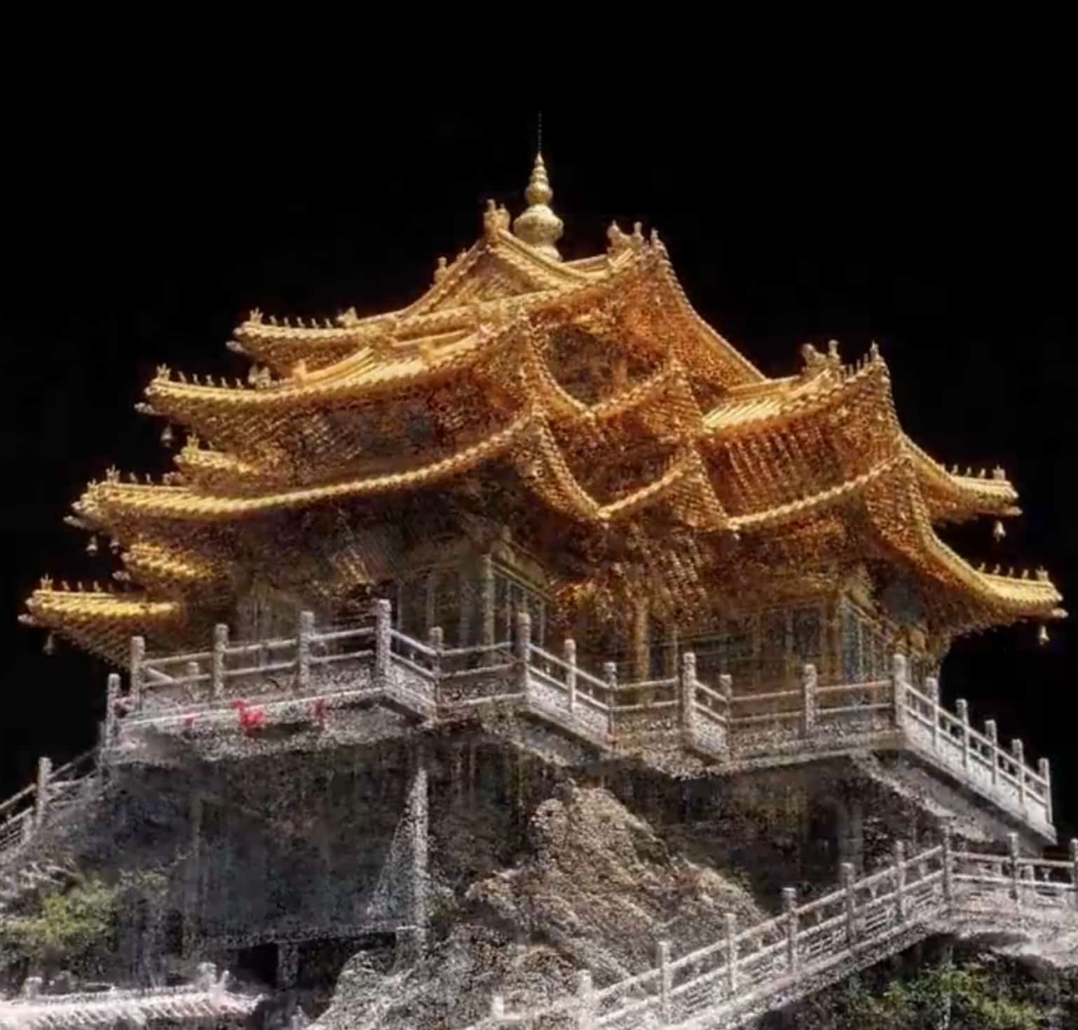
The anticipated launch on July 17, 2025, is already hailed as a significant milestone. The teaser imagery creatively transforms raw data into a detailed virtual Japanese castle, echoing real-world scenarios where drone mapping preserves historical assets, facilitates smarter construction, and creates digital replicas of environments. Mapping technology has transcended its niche status, becoming essential infrastructure for cultural heritage, smart cities, agriculture, and emergency response.
“It’s a poetic nod to how drone technology can protect history, build infrastructure, and digitally immortalize our surroundings.”
Discovering DJI Terra and DJI Modify: Core Tools for Digital Mapping
DJI Terra: Key Features and Upgrades
DJI Terra, the flagship mapping and modeling software, transforms drone data into actionable maps and models:
- 2D & 3D Processing: Turns drone flights into orthomosaic maps, dense point clouds, mesh models, and digital terrain.
- Lidar & Photogrammetry: Combines lidar data and standard RGB camera images for high-fidelity reconstructions, suitable even for complex structures like bridges.
- Smart 3D Capture (with Matrice 4E): An AI-driven, subject-focused flight route automates angle capture, enhancing detail and workflow efficiency.
- PPK Correction: Offers high-precision geolocation for drones like the Matrice 4E, enabling accurate mapping even without real-time connectivity.
- Advanced Visualization: Recent updates include support for point mesh, contour lines, and triangulated networks for superior analysis.
- AI-enabled Features: Includes water surface modeling and seven-parameter geodetic transformations for cutting-edge accuracy.
Recent Versions in Action
v4.4 (Released March 2025): Introduced Smart 3D Capture, fuse lidar and visible light data, direct support for Matrice 4E PPK, major flight route automation enhancements, and a refined 3D reconstruction process.
v4.0.0 and later: Compatibility with modern NVIDIA GPUs is now required, emphasizing online licensing and improved support for Zenmuse L2 sensors.
DJI Modify: Precision Tools for 3D Editing
DJI Modify is the companion software for editing and enhancing 3D models created by DJI Terra. Professionals can now:
- Utilize enhanced selection tools (by object type, color, brush, or single point) for intuitive model refinement and surface cleaning.
- Customize point cloud display and classification colors for better visualization, especially for large or multilayer projects.
- Handle larger undo histories (up to 50 steps), supporting creative experimentation.
- Use real-time coordinate feedback, critical for precision georeferencing.
This software duo—Terra for capture and modeling, Modify for finishing touches—is the core of DJI’s digital twin and smart asset creation workflow.
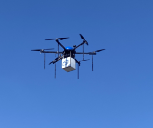
The Matrice 4E: Advancing 3D Mapping Capabilities
DJI’s latest drones, particularly the Matrice 4E, are closely integrated with the advancing Terra suite:
- 5-Directional Oblique Capture: The drone adjusts its gimbal to capture multiple angles without additional flights, enhancing data quality and workflow.
- Best-in-class Imaging: Features a 4/3-inch CMOS, 20MP mechanical shutter, and 0.5-second shooting interval, optimized for precise ground sampling distances day or night.
- Onboard Smart 3D Sketch Preview: Allows pilots to review preliminary models and enable the drone to autonomously plan detailed shots.
- Applications span surveying, heritage conservation, construction oversight, and digital twin creation.
Anticipating the July 17 Launch: Trends and Innovations
Based on official teasers and recent upgrades, here’s what drones users, map-hackers, and digital architects can anticipate:
- Significant UI/UX Updates: Enhancements to interfaces and workflows seem likely, given the push towards automation and AI-powered flight planning.
- Improved AI Processing: Likely expansions of machine learning for object classification and automatic GCP/target identification.
- Faster Multi-GPU Support: Current builds already utilize powerful GPUs for rapid model generation and large dataset management.
- Enhanced Ecosystem Connectivity: Stronger integration between drones, sensors, Terra, Modify, and possibly third-party GIS/BIM suites.
- Versatile Workflows: Seamlessly switch between large area mapping and focused object scans, potentially incorporating hybrid lidar-photogrammetry in one pass.
- Cloud Asset Integration: As digital twins grow, expect near-instant sharing, annotation, and collaboration capabilities.
Although DJI’s teasers haven’t confirmed specific features, an advancement in professional geospatial capabilities is assured.
Beneficiaries: From Construction to Conservation
The ripple effects of enhanced 3D mapping resonate across sectors:
- Surveyors and Civil Engineers: Build terrain models, oversee construction, and verify asset integrity with precision.
- Conservationists: Digitally archive monuments, plan restorations, and track environmental changes.
- Public Safety: Quickly map accident or disaster areas to aid response, reconstruction, and investigation.
- Agriculture: Produce field topographies for improved irrigation, crop tracking, and yield analysis.
- Smart Cities & Digital Twins: Develop up-to-date, interactive “virtual cities” for planning, infrastructure oversight, and public engagement.
Real-World Application: Cultural Heritage Digital Preservation
Recent DJI software updates showcased raw mapping points morphing into a detailed Japanese castle, symbolizing the power of drone photogrammetry in preserving sites endangered by time, disaster, or development. Museums and urban planners are increasingly utilizing drone-based mapping to document and recreate buildings, sculptures, and entire neighborhoods.
Guidance for Drone Operators and Mapping Experts
- Choose Compatible Hardware: High-resolution mapping benefits from drones like the Matrice 4E and modern CUDA-capable graphics cards.
- Optimize Pre-Planning: Use Smart 3D Capture for structures and traditional grids for expansive areas.
- Ensure Accuracy: Import ground control points (GCP) and verify model precision with checkpoints for legal or official surveys.
- Explore Visualization Tools: Customize mesh, contour, and triangulated network outputs for your industry’s requirements.
- Foster Iteration: Use DJI Modify’s undo history to experiment and refine final assets.
- Stay Informed: Monthly updates deliver features and compatibility improvements; follow DJI’s enterprise blog for insights.
- Engage with Community: Forums and user stories provide valuable insights—many mapping innovations arise from shared tips.
DJI and the Future of Mapping: Beyond the Hype
DJI’s unrelenting progress in creating a cohesive ecosystem—from advanced drones to cutting-edge mapping AI—is setting the benchmark for geospatial professionals worldwide. The upcoming July 17 launch signifies more than just a product release; it underlines drones’ evolving role as fundamental tools for constructing, managing, and deciphering our physical surroundings.
As one expert observed, “A drone without mapping software is akin to a smartphone without the internet—fun, but you’re missing the real magic.”
Whether preserving historic temples, designing a smart city, or simply capturing your backyard in stunning 3D, DJI’s latest software enhancements promise not to be missed.
Want to Explore Further?
- Check out DJI’s official blog and enterprise resources.
- Watch tutorials and user stories—nothing beats seeing real-world results in action.
- Get involved: Download demo projects, try new features, and share your feedback within the professional mapping community.
Mark your calendars for July 17—your next significant mapping adventure is about to get a substantial upgrade.