DJI Provides Insight on Recent Geofencing Changes
DJI, known as the world’s largest drone manufacturer, has recently disclosed reasons for its decision to eliminate geofencing restrictions across its drones. This adjustment includes the lifting of flight limitations near sensitive areas such as the White House. The explanation follows an incident where a small DJI drone collided with an airplane during LA wildfire operations. DJI clarified that the timing of this policy shift was pre-planned, with some changes already implemented in Europe and the UK months prior.
Adam Welsh, DJI’s global policy head, stressed that the initial geofencing system was adopted when consumer drones started to be widely used, aimed at filling regulatory gaps. However, according to Welsh, regulatory agencies have not mandated such geofencing requirements as a safety measure in the past decade.
“It was never going to stop a malicious actor from taking improper actions,” Welsh noted, indicating that the system was vulnerable to circumvention, for example through GPS signal blockage. Instead, regulatory focus has shifted toward other safeguards, such as mandatory training and permissions for controlled airspace access.
Impact on Emergency Response
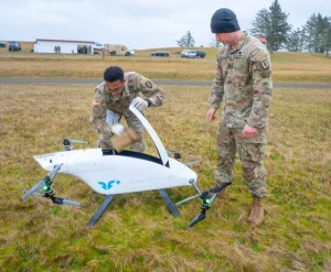
One significant factor influencing DJI’s decision was the effect of geofencing on emergency personnel’s operations. Wayne Baker, DJI’s director of public safety integration, pointed out that such restrictions could hinder crucial rescue efforts. “In scenarios like locating a missing child in bad weather, we don’t have the luxury to go through extensive permission processes,” he explained.
Although DJI does not have documented instances where delays due to geofencing have resulted in fatalities, their drone rescue map has indicated over 1,000 lives saved through drone-assisted rescues since 2013.
Aligning with Regulatory Frameworks
DJI’s new policy aligns with common aviation principles, placing the onus of responsibility on drone operators. Welsh compared this situation to traditional aircraft operations, where pilots are expected to know and comply with relevant airspace regulations rather than relying solely on technology to prevent errors.
DJI reassured users that the removal of geofencing does not equate to neglecting safety protocols. The company will still provide warnings about restricted zones; however, the responsibility for compliance now rests on the operators.
Operational and Economic Advantages
Eliminating geofencing also resolves several operational complications, especially in urban environments. Notably, nearly half of the urban airspace in the U.S. is classified as controlled, which previously necessitated extensive approval processes for everyday activities, like roof inspections.
Moreover, this change alleviates some administrative burdens on DJI, which previously required personnel to manage unlocking requests around the clock. Although the cost savings were not the primary motivation, the reduction in administrative tasks is a positive byproduct.
Context and Future Implications
This significant policy shift comes at a pivotal moment for DJI as the company navigates potential regulatory restrictions in the U.S. market due by December 2025 unless deemed secure by relevant federal agencies. DJI has previously cleared several security assessments from U.S. federal entities, including the Department of Homeland Security and the Pentagon.
The removal of geofencing reflects a notable evolution in DJI’s approach to drone safety and access. While the company continues to inform operators about restricted areas, it has fundamentally shifted compliance responsibilities to them, in line with the broader regulatory landscape.
This change represents a crucial moment in drone safety strategies and how manufacturers manage airspace restrictions. As this initiative unfolds, its effectiveness, particularly regarding sensitive locations and emergency situations, will be closely examined by industry professionals and regulatory bodies alike.
Images courtesy of Billy Kyle.