How Telespazio Ibérica Connects Space and Earth Technologies
Telespazio Ibérica is making significant strides in environmental protection, disaster response, and climate monitoring through its advanced geoinformation services. The innovative initiatives and technologies discussed in this article detail how Telespazio Ibérica is bridging the technological gap between space and Earth.

With over 35 years of expertise, Telespazio Ibérica excels in cartography and remote sensing. As a member of the Telespazio joint venture formed by Leonardo and Thales, the company operates across critical sectors, such as geoinformation, satellite communications, and navigation.
Headquartered in Spain, Telespazio Ibérica offers comprehensive services covering the complete asset management cycle—from generating maps with cutting-edge technologies to software solutions that integrate Geographic Information Systems (GIS), satellite communications (SatCom), and advanced Unmanned Aerial Systems (UAS) services.
The company caters to various high-tech sectors, including defense, energy and utilities, telecommunications, public administration, transport, emergency services, and large corporations, delivering innovative solutions to meet the evolving needs of these industries.
Tackling Global Sustainability Challenges
Committed to leveraging space technologies to tackle sustainability challenges, Telespazio Ibérica actively engages in environmental protection, disaster response, and climate monitoring through its advanced geoinformation services.
A notable example of this commitment is its partnership with the Copernicus Emergency Management Service (EMS) Rapid Mapping program. Telespazio Ibérica plays a critical role in land monitoring, disaster assessment, and environmental conservation, utilizing its remote sensing competencies to support initiatives in deforestation monitoring, biodiversity protection, and climate impact analysis. Through satellite imagery, the company generates maps that assist emergency services.
Advancements in Technology
Telespazio Ibérica further propels space technology advancements by continuously innovating in geospatial intelligence, satellite data analytics, and UAV solutions. Recent technological breakthroughs include:
- Advanced SAR Processing: Utilizing data from COSMO-SkyMed satellites, Telespazio Ibérica offers high-resolution radar imaging for urban planning, infrastructure monitoring, and defense applications.
- AI-Driven Remote Sensing: The firm employs AI and Big Data to enhance the analysis of satellite imagery, improving land classification and assessments of vegetation health and maritime surveillance.
- UAV and Satellite Data Integration: Through the Civil UAV Initiative in Galicia, innovative UAV solutions are being developed for biodiversity monitoring, precision agriculture, and emergency response, merging drone with satellite imagery for enhanced data analysis.
- Geospatial Solutions for Energy and Utilities: Collaborations with major companies like Naturgy and Enel result in GIS-based asset management and risk assessment solutions that bolster the efficiency and sustainability of power networks.
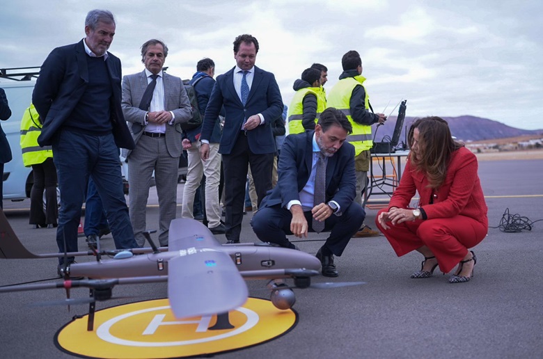
- ISSEC Initiatives: As part of the Canarias Geo Innovation Program 2030, Telespazio Ibérica engages in R&D projects focused on biodiversity management, wildfire prevention, and logistics in hospitals. This summer, they will employ Leonardo’s Falco EVO on Fuerteventura island, a MALE remotely piloted aircraft capable of exceeding 20 hours of operation.
Providing Intelligent and Predictive Analytics
A clear trend is emerging in the Earth Observation (EO) sector from delivering raw satellite images to offering comprehensive data-driven services. Clients now seek actionable insights, prompting Telespazio Ibérica to refine its offerings into end-to-end solutions that incorporate:
- AI-enhanced image processing for automatic detection of land changes, environmental risks, and infrastructure irregularities.
- Customizable analytics dashboards for real-time monitoring of critical variables.
- Consolidated satellite and UAV data to facilitate precise and localized decision-making.
The Advantages of Satellite and Drone Imagery
Satellite imagery effectively covers extensive areas, making it suitable for monitoring land, analyzing climate change, and managing disasters. It also provides historical datasets, enabling organizations to observe alterations over time and gather information in inaccessible regions where drones may not operate.
Conversely, drone imagery features higher spatial resolution, making it invaluable for localized inspections such as infrastructure evaluations and precision agriculture. With real-time data acquisition capabilities, drone imagery complements satellite data, particularly when detailed analysis is required in critical regions.
For more insightful articles, subscribe to our newsletter!