Maxar Unveils Raptor: Cutting-Edge Software for GPS-Independent Drone Navigation
WESTMINSTER, Colo. – Maxar Intelligence has introduced Raptor, a groundbreaking software suite designed to empower autonomous drones to navigate and identify precise ground coordinates even in environments where GPS is unavailable. This innovative technology significantly boosts the reliability of unmanned systems, paving the way for enhanced autonomy in various sectors including military, humanitarian, and commercial operations.
Raptor seamlessly integrates with any autonomous platform, utilizing only the drone’s built-in camera and Maxar’s extensive repository of over 90 million square kilometers of global 3D terrain data. This allows for real-time navigation with exceptional accuracy, even under challenging conditions such as nighttime operations or low-visibility environments.
“Raptor software eliminates the dependency on GPS, unlocking the comprehensive capabilities of autonomous systems—from executing joint multi-domain operations on the digital battlefield to facilitating large-scale delivery in urban settings where precise drop-off coordinates are essential,” explained Peter Wilczynski, Chief Product Officer at Maxar Intelligence. “This solution will transform the landscape for both defense and commercial clients.”
The Raptor software suite includes three main components:
- Raptor Guide: Vision-based positioning software that is directly installed on the autonomous platform, achieving an absolute accuracy of less than 10 meters RMSE.
- Raptor Sync: A software that synchronizes the drone’s onboard video feed with Maxar’s 3D terrain data in real-time, enhancing intelligence fusion and accurate ground coordinate extraction with an accuracy of less than 3 meters.
- Raptor Ace: A software tool that runs on standard laptop setups alongside drone controllers, enabling operators to derive real-time target ground coordinates from full-motion video with a precision of less than 3 meters.
Raptor sets itself apart in the market by offering substantial benefits compared to traditional visual-based navigation options:
- Cost and Power Efficiency: Raptor can be deployed on common hardware with minimal integration requirements, unlike other navigation solutions needing additional equipment.
- Versatility in Complex Missions: It operates effectively at night and in diverse seasonal conditions, functioning at altitudes as low as 120 meters.
- Scalable Autonomy: By anchoring sensor data to a unified geospatial foundation, Raptor facilitates coordination among diverse unmanned systems regardless of varying software or hardware.
- Utilizes Existing Cameras: Raptor is compatible with the drone’s standard optics, mitigating the need for dedicated cameras that can weigh down the payload.
Maxar Intelligence is a premier provider of secure and accurate geospatial insights, employing advanced commercial Earth observation technologies to deliver mission-critical information swiftly. For more information, visit Maxar’s official site.
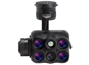
For further details, check out the images below showcasing Raptor’s capabilities: