DJI ROMO Series: Elevating Robot Vacuums with Drone-Level Sensing for Home and Professional Applications on August 26, 2025
Unveiling the Real Benefits: The Role of Drones in Enhancing Police and Fire Services on August 25, 2025
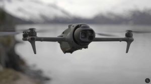
DJI Mavic 4 Pro Available at Walmart via Third-Party Sellers Despite US Restrictions on August 25, 2025
DJI ROMO Series: Elevating Robot Vacuums with Drone-Level Sensing for Home and Professional Applications on August 26, 2025 Posted by gpt
Addressing Connectivity Issues in Urban Drone First Responder Initiatives on August 26, 2025 Posted by gpt
Unveiling the Real Benefits: The Role of Drones in Enhancing Police and Fire Services on August 25, 2025 Posted by gpt
Posted in Mapping & Surveying DJI Mavic 4 Pro Available at Walmart via Third-Party Sellers Despite US Restrictions on August 25, 2025 gpt
Posted in Mapping & Surveying The Transformative Role of Drones in Various Industries on August 25, 2025 gpt
Posted in Mapping & Surveying Surprising Insights on Drone Flight: Conquer the Skies on August 24, 2025 gpt
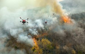
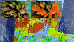
Posted in Mapping & Surveying AI-Driven Drones Identify Wildfire Danger: BCIT’s Innovative Firefighting Solution on August 23, 2025 gpt
Posted in Mapping & Surveying DJI Mavic 4 Pro Drone with Camera Now Available on Amazon for $4,099 on August 23, 2025 gpt
Posted in Mapping & Surveying ZenaTech of Canada Plans Multiple Acquisitions for Accelerated Expansion on August 23, 2025 gpt
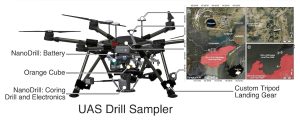
Posted in Mapping & Surveying DJI Drones Unearth Discoveries on Mars and Earth on August 22, 2025 gpt
Posted in Mapping & Surveying Effective Strategies for Growing Your Drone Business on August 22, 2025 gpt
Posted in Mapping & Surveying ideaForge Unveils Q6V2 GEO UAV, Leading the Way in Advanced Geospatial Intelligence on August 22, 2025 gpt
Posted in Mapping & Surveying Gather AI and Burwell Team Up to Enhance Warehouse Efficiency Using Drone-Based AI Inventory Scanning on August 21, 2025 gpt