The Future of BVLOS Operations in Surveying and Mapping
Since their debut in cartography over a decade ago, unmanned aerial vehicles (UAVs), commonly referred to as drones, have transformed the landscape of photogrammetry and land surveying. Despite their advantages, regulatory limitations have historically restricted their use to small areas and simpler tasks.
In the summer of 2016, the Federal Aviation Administration (FAA) implemented the Part 107 regulation, which permitted drones to operate within the National Airspace System (NAS) under strict guidelines, notably requiring that they remain within the operator’s visual range. This limitation posed significant challenges for large-scale photogrammetric missions, which typically cover extensive areas to optimize costs and take advantage of favorable weather conditions.
The Implications of Part 108
With the anticipated publication of a Notice of Proposed Rulemaking (NPRM) regarding Part 108, we expect to see changes in regulations over the next two years. This new rule is significant as it aims to allow for Beyond Visual Line of Sight (BVLOS) operations, thereby permitting drones to fly further from their operators as long as communication is maintained consistently and reliably.
The emphasis on ensuring 100% reliability and redundancy is crucial, making the FAA’s deliberations understandably thorough. However, innovative solutions are being developed to demonstrate to the FAA that drones can safely operate alongside manned aircraft in the NAS.
Advantages for the Mapping Industry
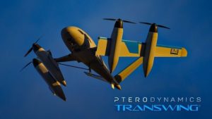
Once Part 108 is enacted, fixed-wing drones will be able to operate at higher altitudes and for extended durations, which translates to greater coverage on surveying projects. Existing non-piloted aerial systems that stand to benefit from these advancements include:
- AgEagle eBee – aBee X – 90 minutes flight time. Can map 1,235 acres at an altitude of 400 ft with a payload of 3.6 lbs.
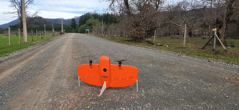
- Wingtra – Wingtra One Gen II – 59 minutes flight time. Can map 1,140 acres at 400 ft altitude with a 1.8 lbs payload.
- Quantum Systems – Trinity Pro – 90 minutes flight time. Can map 1,729 acres at 400 ft altitude with a 2.68 lbs payload.
- Delair – UX11 – 80 minutes flight time. Can map 300 acres at 400 ft altitude with a 1.5 lbs payload.
Case Study: Public Utility Corridor
A practical example of the advantages of BVLOS operations is illustrated by a project that utilized a special waiver, allowing flights beyond the operator’s visual range. Here are the project requirements:
- Length of corridor: 12.42 miles
- Width of corridor: 1,500 ft
- 80% longitudinal overlap
- 70% lateral overlap
- Ground Sample Distance (GSD): 1.2 inches
The mission was successfully completed using a Wingtra drone equipped with a 42 MP camera. The specifics of the flight included:
- Altitude: 820 ft
- Speed: 31 knots (approximately 36 mph)
- Flight time: 6.1 hours
This operation underscores the potential time savings and efficiency gains possible under the new regulations compared to traditional multicopter methods, which often require extensive time to meet altitude and operational restrictions.
As we anticipate the implementation of Part 108, exploring UAV platforms capable of enhanced performance in this evolving regulatory environment is advisable. Although the full integration of crewed and uncrewed aircraft into the NAS might still be years away, advancements in aerial mapping and photogrammetry are becoming more accessible to land surveyors globally.